Thursday, June 27, 2013

The Threat of Wildfires in the North

NASA/NOAA image based on Suomi NPP satellite data from April 2012 to April 2013, with grid added
A new map has been issued by NOAA/NASA. The map shows that most vegetation grows in two bands, i.e. the Tropical Band (between latitudes 15°N and 15°S) and the Northern Band in between 45°N and 75°N, i.e. in North America, Europe and Siberia. On above image, the map is roughly overlayed with a grid to indicate latitude and longitude co-ordinates.


Vegetation in the Northern Band extends beyond the Arctic Circle (latitude 66° 33′ 44″ or 66.5622°, in blue on above image from Arcticsystem.no) into the Arctic, covering sparsely-populated areas such in Siberia, Alaska and the northern parts of Canada and Scandinavia. Further into the Arctic, there are huge areas with bush and shrubland that have taken thousands of years to develop, and once burnt, it can take a long time for vegetation to return, due to the short growing season and harsh conditions in the Arctic.


Above map with soil carbon content further shows that the top 100 cm of soil in the northern circumpolar region furthermore contains huge amounts of carbon.

May 16 2013 Drought 90 days Arctic
Global warming increases the risk of wildfires. This is especially applicable to the Arctic, where temperatures have been rising faster than anywhere else on Earth. Anomalies can be very high in specific cases, as illustrated by the temperature map below. High temperatures and drought combine to increase the threat of wildfires (see above image showing drought severity).

June 25, 2013 from Wunderground.com - Moscow broke its more than 100-year-old record for the hottest June 27
Zyryanka, Siberia, recently recorded a high of 37.4°C (99.3°F), against normal high temperatures of 20°C to 21°C for this time of year. Heat wave conditions were also recorded in Alaska recently, with temperatures as high as 96°F (36°C).

On June 19, 2013, NASA captured this image of smoke from wildfires burning in western Alaska. The smoke was moving west over Norton Sound. (The center of the image is roughly 163° West and 62° North.) Red outlines indicate hot spots with unusually warm surface temperatures associated with fire. NASA image by Jeff Schmaltz, LANCE/EOSDIS Rapid Response. Caption by Adam Voiland. - also see this post with NASA satellite image of Alaska.
Siberian wildfires June 21, from RobertScribbler 
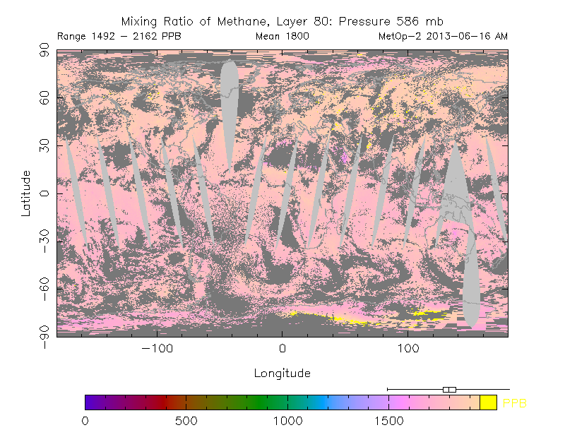
from methanetracker.org

Wildfires raged in Russia in 2010. Flames ravaged 1.25 million hectares (4,826 mi²) of land including 2,092 hectares of peat moor.

Damage from the fires is estimated to be $15 billion, in a report in the Guardian.

Cost of fire-fighting efforts and agricultural losses alone are estimated at over $2bn, reports Munich Re, adding that Moscow's inhabitants suffered under a dense cloud of smoke which enveloped the city. In addition to toxic gases, it also contained considerable amounts of particulate matter. Mortality increased significantly: the number of deaths in July and August was 56,000 higher than in the same months in 2009. 


[From: Abrupt Local Warming, May 16, 2012]

Wildfires in the North threaten to cause large emissions of greenhouse gases and soot, which can settle on snow and ice in the Arctic and the Himalayan Plateau, with the resulting albedo changes causing a lot more sunlight to be absorbed, instead of reflected as was the case earlier. This in turn adds to the problem. Additionally, rising temperatures in the Arctic threaten to cause release of huge amounts of methane from sediments below the Arctic Ocean. This situation threatens to escalate into runway global warming in a matter of years, as illustrated by the image below.

How much will temperatures rise?
In conclusion, the risk is unacceptable and calls for a comprehensive and effective action plan that executes multiple lines of action in parallel, such as the 3-part Climate Action Plan below. Part 1 calls for a sustainable economy, i.e. dramatic reductions of pollutants on land, in oceans and in the atmosphere. Part 2 calls for heat management. Part 3 calls for methane management and further measures.


The Climate Action Plan set out in above diagram can be initiated immediately in any country, without the need for an international agreement to be reached first. This can avoid delays associated with complicated negotiations and on-going verification of implementation and progress in other nations.

In nations with both federal and state governments, such as the United States of America, the Climate Action Plan could be implemented as follows:
  • The President directs federal departments and agencies to reduce their emissions for each type of pollutant annually by a set percentage, say, CO2 and CH4 by 10%, and HFCs, N2O and soot by higher percentages.
  • The President demands states to each make the same cuts. 
  • The President directs the federal Environmental Protection Agency (EPA) to monitor implementation of states and to act step in where a state looks set to fail to miss one or more targets, by imposing (federal) fees on applicable polluting products sold in the respective state, with revenues used for federal benefits.
Such federal benefits could include building interstate High-Speed Rail tracks, adaptation and conservation measures, management of national parks, R&D into batteries, ways to vegetate deserts and other land use measurements, all at the discretion of the EPA. The fees can be roughly calculated as the average of fees that other states impose in successful efforts to meet their targets.

This way, the decision how to reduce targets is largely delegated to state level, while states can similarly delegate decisions to local communities. While feebates, preferably implemented locally, are recommended as the most effective way to reach targets, each state and even each local community can largely decide how to implement things, provided that each of the targets are reached.

Similar targets could be adopted elsewhere in the world, and each nation could similarly delegate responsibilities to local communities. Additionally, it makes sense to agree internationally to impose extra fees on international commercial aviation, with revenues used to develop ways to cool the Arctic.

- Climate Plan


Saturday, June 22, 2013

Open Water In Areas Around North Pole

In some areas around the North Pole, thickness of the sea ice has declined to virtually zero, i.e. open water.


What could have caused this open water? Let's go through some of the background.

North Hemisphere snow cover has been low for some time. Snow cover in May 2013 was the lowest on record for Eurasia. There now is very little snow left, as shown on the image right, adapted from the National Ice Center.

Low snow cover is causing more sunlight to be absorbed, rather than reflected back into space. As can be expected, there now are high surface temperatures in many areas, as illustrated by the NOAA image below. Anomalies can be very high in specific cases. Zyryanka, Siberia, recently recorded a high of 37.4 C, against normal high temperatures of 20 C to 21 C for this time of year. Heat wave conditions were also recorded in Alaska recently (satellite image of Alaska below).

NASA image June 17, 2013, credit: NASA/Jeff Schmaltz, LANCE MODIS Rapid Response Team, NASA GSFC - from caption by Adam Voiland: "Talkeetna, a town about 100 miles north of Anchorage, saw temperatures reach 96°F (36°C) on June 17. Other towns in southern Alaska set all-time record highs, including Cordova, Valez, and Seward. The high temperatures also helped fuel wildfires and hastened the breakup of sea ice in the Chukchi Sea."
Accordingly, a large amount of relatively warm water from rivers has flowed into the Arctic Ocean, in addition to warm water from the Atlantic and Pacific Oceans.


Sea surface temperatures have been anomalously high in many places around the edges of the sea ice, as also shown on the NOAA image below.


Nonetheless, as the above images also make clear, sea surface temperatures closer to the North Pole have until now remained at or below zero degrees Celsius, with sea ice cover appearing to remain in place. The webcam below from the North Pole Environmental Observatory shows that there still is a lot of ice, at least in some parts around the North Pole.

Webcam #2 of the North Pole Environmental Observatory monitoring UPMC's Atmospheric Buoy, June 21, 2013
So, what could have caused the sea ice to experience such a dramatic thickness decline in some areas close to the North Pole?

Firstly, as discussed in earlier posts, there has been strong cyclonic activity over the Arctic Ocean (see also Arctic Sea Ice blog post). This has made the sea ice more prone and vulnerable to the rapid decline that is now taking place in many areas.

Furthermore, Arctic sea ice thickness is very low, as illustrated by the image below.

Arctic sea ice volume/extent ratio, adapted by Sam Carana from an image by Neven (click to enlarge)
Finally, there has been a lot of sunshine at the North Pole. At this time of year, insolation in the Arctic is at its highest. Solstice (June 20 or June 21, 2013, depending on time zone) is the day when the Arctic receives the most hours of sunlight, as Earth reaches its maximum axial tilt toward the sun of 23° 26'. In fact, insolation during the months June and July is higher in the Arctic than anywhere else on Earth, as shown on the image below.

Monthly insolation for selected latitudes -  adapted from Pidwirny, M. (2006), in "Earth-Sun Relationships and Insolation",  Fundamentals of Physical Geography, 2nd Edition
In conclusion, the current rapid sea ice thickness decline close to the North Pole is mostly due to a combination of earlier cyclonic activity and lots of sunlight, while the sea ice was already very thin to start with. The cyclone broke up the sea ice at the center of the Arctic Ocean, which is turn made it more prone to melting rapidly. The cyclone did more, though, as contributor to the Arctic-news blog Veli Albert Kallio explains:
"The ocean surface freezes if the temperature falls below -2.5C. The reason for the negative melting point is the presence of 4-5% of sea salt. Only in the polar regions does the sea surface cool sufficiently for sea ice to form during winters.

The sea ice cover is currently thinning near the North Pole between 80-90 degrees north. This part of the ocean is very deep. It receives heat of the Gulf Stream from the south: as the warm water vapourises, its salt content to water increases. This densifies the Gulf Stream which then falls onto the sea floor where it dissipates its heat to the overlying water column. The deep basin of the Arctic Ocean is now getting sufficiently warmed for the thin sea ice cover to thin on top of it. The transportation of heat to the icy surface is combined with the winds that push cold surface water down while rising heat to surface."
Indeed, vertical mixing of the water column was enhanced due to cyclonic activity, and this occurred especially in the parts of the Arctic Ocean that also are the deepest, as illustrated by the animation below.
Legend right: Ice thickness in m from Naval Research Laboratory
Legend bottom: Sea depth (blue) and land height (brown/green)
in m from NIBCAO Arctic map at NOAA
The compilation of images below shows how the decline of sea ice has taken place in a matter of weeks.

[ click to enlarge ]
This spells bad news for the future. It confirms earlier analyses (see links below) that the sea ice will disappear altogether within years. It shows that the sea ice is capable of breaking up abruptly, not only at the outer edges, but also at the center of the Arctic Ocean. As the Arctic sea ice keeps declining in thickness, it does indeed look set to break up and disappear abruptly across most of the Arctic Ocean within a few years. Models that are based on sea ice merely shrinking slowly from the outer edges inward should reconsider their projections accordingly.

Related

- Getting the Picture
http://arctic-news.blogspot.com/2012/08/getting-the-picture.html

- Supplementary evidence by Prof. Peter Wadhams
http://arctic-news.blogspot.com/2012/04/supplementary-evidence-by-prof-peter.html

Thursday, June 20, 2013

Extreme weather becomes the norm - what can you do?

. . a sky that has turned red due to greenhouse gases, while the land is flooded. The handful of
people who survived are standing by helplessly on higher grounds, in despair and without hope,
while one figure turns to me in panic and pain, uttering nothing but a silent scream . . .
(comment by Sam Carana, March 8, 2012, on auction of the Scream, by Edvard Munch)

Symptoms

Torrential rains in some regions are causing massive floods while in other locales record droughts are occurring with higher frequency and severity and areal extent around the globe. Global food production is being hit hard, leading to large price increases and political instability. Areas under drought are experiencing numerous massive forest fires of incredible ferocity.

Causes

The statistics of extreme weather events have changed for the worst due to changes in the location, speed, and waviness of the jet streams which guide weather patterns and separate cold and dry northern air from warm and moist southern air. The jet streams have changed since the equator to north-pole temperature difference has decreased due to the huge temperature rise in the Arctic.

The huge temperature rise in the Arctic is due to a collapse in the area of highly reflective snow and ice, which is caused by melting. The melting is from warming from the increase of greenhouse gases from fossil fuel burning. The Arctic sea ice and spring snow cover will vanish within a few years and the weather extremes will increase at least 10x.

What can you do?

Go talk to you politicians and friends about climate change and the need to slash fossil fuel emissions. Immediately. Cut and paste my comments above and post them on facebook, send them to newspapers, and educate yourself on the science behind all the above linkages. Leave my name on or take it off and plagiarize all you want, just get this knowledge out there...

From an unmuzzled climate scientist...
Paul Beckwith, B.Eng, M.Sc. (Physics),
Ph.D. student (Climatology) and Part-time Professor,
University of Ottawa

originally posted as a comment under the CBCnews post:
Calgary braces for flooding, orders communities evacuated 

Related

- The Tornado Connection to Climate Change
- President Obama, here's a climate plan!
- Diagram of Doom
- Polar jet stream appears hugely deformed
Ten Dangers of Global Warming (originally posted March 8, 2007)

Tuesday, June 18, 2013

Mean Methane Levels reach 1800 ppb

On May 9, the daily mean concentration of carbon dioxide in the atmosphere of Mauna Loa, Hawaii, surpassed 400 parts per million (ppm) for the first time since measurements began in 1958. This is 120 ppm higher than pre-industrial peak levels. This unfortunate milestone was widely reported in the media.

There's another milestone that looks even more threatening than the above one. On the morning of June 16, 2013, methane levels reached an average mean of 1800 parts per billion (ppb). This is more than 1100 ppb higher than levels reached in pre-industrial times (see graph further below).
NOAA image
Vostok ice core analysis shows that temperatures and levels of carbon dioxide and methane have all moved within narrow bands while remaining in sync with each other over the past 400,000 years. Carbon dioxide moved within a band with lower and upper boundaries of respectively 200 and 280 ppm. Methane moved within lower and upper boundaries of respectively 400 and 800 ppb.
Temperatures moved within lower and upper boundaries of respectively -8 and 2 degrees Celsius.

From a historic perspective, greenhouse gas levels have risen abruptly to unprecedented levels. While already at a historic peak, humans have caused emissions of additional greenhouse gases. There's no doubt that such greenhouse gas levels will lead to huge rises in temperatures. The question is how long it will take for temperatures to catch up and rise.


Below is another way of looking at the hockey stick. And of course, further emissions could be added as well, such as nitrous oxide and soot.


Large releases of methane must have taken place numerous times in history, as evidenced by numerous pockmarks, as large as 11 km (6.8 mi) wide.

Importantly, large methane releases in the past did not result in runaway global warming for a number of reasons:
  • methane release typically took place gradually over many years, each time allowing a large release of methane to be broken down naturally over the years before another one occurred. 
  • Where high levels of methane in the atmosphere persisted and caused a lot of heat to be trapped, this heat could still be coped with due to greater presence of ice acting as a buffer and consuming the heat before it could escalate into runaway temperature rises.
Wikipedia image
Veli Albert Kallio comments:

The problem with ice cores is that if there is too sudden methane surge, then the climate warms very rapidly. This then results the glacier surfaces melting away and the ice core begins to loose regressively surface data if there is too much methane in the air.

Because of this, there has been previous occurrences of high methane, and these were instrumental to bring the ice ages ice sheets to end (Euan Nisbet's Royal Society paper). The key to this is to look at some key anomalies and devise the right experiments to test the hypothesis for methane eruptions as the period to ice ages.

Thus, the current methane melting and 1800 ppm rise is nothing new except that there are no huge Pleistocene glaciers to cool the Arctic Ocean if methane goes to overdrive this time. In fact methane may have been many times higher than that but all surface ice kept melting away and staying regressive until cold water and ice from destabilised ice sheets stopped the supply of methane (it decays fast if supply is cut and temperatures fall back rapidly when seas rose).

The Laurentide Ice Sheet alone was equivalent of 25 Greenland Ice Sheets and the Weischelian and other sheets on top of that. So, the glaciers do not act the same way as fireman to extinguish methane. Runaway global warming is now possibility if the Arctic loses its methane holding capability due to warming.

Further discussion is invited on the following points:
  • The large carbon-12 emission anomalies in East Asian historical objects that are dateable by historical knowledge. Discussion about the explanations concocted and why methane emission from permafrost soils and sea beds must be the answer; 
  • the much overlooked fact that if there were ever very highly elevated concentrations of air in the Arctic, this would induce strong melting of glaciers which then lack those surface depositions where the air were most CH4 and CO2 laden. Even moderate levels of temperature rise damaged Larsen A, Larsen B, Petermann and Ellesmere glaciers. If huge runaway outgassing came out when Beringia flipped into soil warming, then methane came out really large amounts with CO2.
  • Discussion of the experiments how to compensate for the possible lack of "time" in methane elevated periods in the ice cores by alternative experiments to obtain daily, weekly, monthly and yearly emission rates of CH4 and CO2 from the Last Glacial Maximum to the Holocene Thermal Maximum (as daily, weekly, monthly, and yearly sampling of air).

Editor's update: Methane levels go up and down with the seasons, and differ by altitude. As above post shows, mean levels reached 1800 ppb in May 2013 at 586 mb, according to MetOp-2 data. Note that IPCC AR5 gives levels of 1798 ppb in 2010 and 1803 ppb in 2011, as further discussed in later posts such as this one. Also, see historic data as supplied by NOAA below.


Sunday, June 16, 2013

Arctic Sea Ice September 2013 Projections

What will the Arctic Sea Ice look like in September 2013?

Several projections for Arctic sea ice extent are being discussed at places such as ARCUS (Arctic Research Consortium of the United States) and the Arctic Sea Ice Blog. The image below, from ARCUS, shows various projections of September 2013 arctic sea extent (defined as the monthly average for September) with a median value of 4.1 million square kilometers, with quartiles of 3.8 and 4.4 million square kilometers.


Note that sea ice extent in the above projections is defined as area of ocean with at least 15% ice, in line with the way the NSIDC calculates extent. By contrast, the Danish Meteorological Institute includes areas with ice concentration higher than 30% to calculate ice extent.

Rather than looking at the projected average for September, one could also project the minimum value for September 2013. And rather than looking at sea ice extent, one could also look at sea ice area, which differs from sea ice extent as the NSIDC FAQ page describes:
A simplified way to think of extent versus area is to imagine a slice of Swiss cheese. Extent would be a measure of the edges of the slice of cheese and all of the space inside it. Area would be the measure of where there is cheese only, not including the holes. That is why if you compare extent and area in the same time period, extent is always bigger.


Above image shows Sam Carana's projected minimum area of 2 million square km for 2013, based on data by Cryosphere Today and on numerous factors, such as continued warming of the water underneath the ice, stronger cyclones, etc.
Roughly in line with above image, by Wipneus, Sam Carana's projection for Arctic sea ice minimum volume is 2,000 cubic km in September 2013.

Readers are invited to submit comments below with further projections.

Thursday, June 13, 2013

Arctic sea ice thickness falls by 2m in 21 days in some areas

For years, warnings have been raised about the dramatic decline of Arctic sea ice. Various posts at this blog have also analyzed the exponential nature of the decline in summer sea ice volume and the many feedbacks that fuel this decline. And for years, the conclusion has been that - without action - the sea ice looks set to disappear altogether within years.

Yet, many are still ignoring this warning, often with remarks such as "some of the ice is 5 meters thick; it would take decades for all that ice to melt!" Thick ice does indeed pile up along the northern coast of Greenland and Ellesmere Island, due to the way the ice drifts. This has lead some to argue that an S-shaped curve (sigmoid or gompertz trendline) was more appropriate, with the decline in sea ice volume slowing down as it approaches zero.

However, this argument doesn't seem make much sense, since such a S-shaped trendline would only apply to a relatively small area with very thick sea ice. Exponential curves would still remain the best fit to predict the decline of the sea ice in the Arctic Ocean at large.

Moreover, is it really more appropriate to say that summer sea ice looks set to virtually disappear within years, with just a tiny sliver of ice remaining north of Greenland and Ellesmere Island, instead of saying that the sea ice looks set to disappear altogether within years? How persistent will such a sliver really be?

One of the feedbacks of sea ice decline is that, as the decline progresses, cyclones can be expected to hit the remaining sea ice ever harder. How much damage can such cyclones and further feedbacks do? A previous post describes thin spots developing in the sea ice under the influence of a cyclone. The image below shows areas at the center of the Arctic Ocean (large circle) where thickness of the sea ice fell from 2 meters to 1 meters over a period of 21 days. Furthermore, the image below also shows that, over this period, 5m-thick ice was reduced to 3-meters thickness (top small circle), while 2m-thick ice was reduced to zero (bottom small circle).

2m falls in thickness in 21 days - click on image to enlarge
In conclusion, without action the Arctic sea ice looks set to continue to decline exponentially, while strong feedbacks such as cyclones developing when there is more open water, look set to add to the decline and cause the Arctic sea ice to disappear completely within years. For an overview of lines of action, see this post at the methane hydrates blog.

Thursday, June 6, 2013

Thin Spots developing in Arctic Sea Ice

From the start of 2013, Arctic sea ice extent has roughly followed the same path it did in 2012 when a historic record low was reached, as discussed in a previous post. At the moment, thinner spots are developing in the sea ice, as illustrated by the image below.


These thin spots are developing due to a combination of factors:
  • a cyclone over the Arctic
  • low North Hemisphere snow cover causing more sunlight to be absorbed, rather than reflected back into space
  • warm sea surface temperatures at edges of sea ice, as illustrated by the image below
  • ice thickness is very low, as illustrated by the image further below
NOAA image, click to enlarge
Arctic sea ice volume/extent ratio by Neven (click to enlarge image)
Below, a 30-day Naval Research Laboratory animation illustrating the development of the thinner spots. 

Tuesday, June 4, 2013

The Tornado Connection to Climate Change


By  Paul Beckwith, B.Eng, M.Sc. (Physics),
Ph.D. student (Climatology) and Part-time Professor,
University of Ottawa

"In 2012, 93 percent of natural catastrophes were weather-related disasters. The United States was seriously affected: it accounted for 69% of overall losses and 92% of insured losses due to natural catastrophes worldwide." ~ World Watch Institute

"America has some of the wildest weather on the planet, and it turns out those extremes – which run from heat waves and tornadoes to floods, hurricanes and droughts – carry a heavy price tag." ~ theguardian

3D look at the Moore Oklahoma thunderstorm and tornado, up to 50,000 ft. Image by Tony Petrarca
from Tony's Pinpoint Weather Blog showing the funnel touching the ground just outside of Moore. 
The mega-storm that generated the massive cyclonic system that passed over the central U.S (from May 18th through May 20th) spawned many storm systems and severe tornadoes. In Oklahoma, it took less than 1 hour for a thunderstorm system to develop into a full-blown 3 km diameter tornado of the highest size/strength (EF5). As you know, this tornado caused total devastation along a swath greater than 30 km long and about 3 km wide in the southern part of the city. Two schools and a hospital were destroyed resulting in heavy loss of life.

The actual tornado tracked through the most built up part of the city and had a length of 6.22 km (Image 2). As bad as this was, if the tornado had tracked further north by about 10 km, the path length through the built-up part of the city would have been about 28 km and likely would have resulted in FOUR TIMES MORE DAMAGE.

The high altitude jet stream guided this storm directly over Oklahoma City and was a key ingredient responsible for the extremely rapid development of the tornado witnessed. Unfortunately, the location, strength, waviness, and behavior of the jet stream is changing as a result of rapid climate change. You can get use to more “Climate Bomb” extreme weather events – there is nothing to be surprised about here.

Greenhouse gas emissions from humans have warmed the planet since about 1850; the warming rate has stepped up a notch over the past several decades, and even more so now with ‘feedbacks’ kicking in big time.

There is less snow cover on the land over northern Canada, northern Eurasia and Siberia, and there is less sea ice over the Arctic Ocean. The snow and ice reflects greater than 80% of the incoming light from the sun back into space keeping these areas colder. With less snow the dark land is uncovered and with less sea ice the dark ocean is uncovered. These both reflect much less light; only about 20% and 10% respectively. The rest is absorbed and heats the ground and sea. The melting ground is releasing methane; the warming sea heats the sea floor and that warming releases more methane. Thus, parts of the high Arctic are warming at 5 to 6 times the average global rate. The equator temperature does not change as much (even seasonally the change is only about 3°C over the year). Thus, the temperature gradient between the equator and Arctic is greatly reduced.

By basic physics and meteorology, this reduced equator-pole temperature difference slows the west to east wind component. Fast jet streams circle the earth from west to east; as they slow they become much wavier and travel much more northward and southward. Regions north of the wavy jets are cold and dry (air source is cold Arctic) while regions south of the wavy jets are hot and moist (air source is equatorial marine regions). The jet is thus an intersection of these two different types of air masses (with cold fronts and warm fronts, respectively). The large local temperature gradients give rise to large pressure gradients resulting in extreme (and very unstable) weather regions.

May 20, 2013 Moore, Oklahoma tornado
Since the wave troughs carry cold air very far south and the wave crests carry warm moist air far north, the frontal temperature gradients are larger under climate change then they were before and thus the storm magnitudes are now larger. That’s why I wrote earlier that we shouldn’t be surprised.

Global warming also brings greater ocean evaporation and warmer air can carry more water vapor – in fact, in the last 3 decades or so there has been a 4% increase in atmospheric humidity. When this water vapor condenses to forms clouds, energy is released. Greater energy in the atmosphere thus fuels more violent storms, and Climate Bombs are born.

The Oklahoma tornado is just another example of the global ‘weirding‘ that we are seeing. Our reference frame is the “old climate”, in which the equator-polar temperature gradients are smaller, but the local frontal temperature gradients are larger. In our “new climate” (in which there is much less sea ice in the Arctic) this type of tornado will be much more probable — at least while we abruptly transition from the “old” to the “new” and unfamiliar climate.

Our future is a world with much warmer global temperatures. Paleoclimate records show temperature rises of 6 to 10°C within two decades have occurred many times in the past over Greenland; in one case the rise was 16°C. I see no reason why this will not occur again.

Put your seat belt on . . . oil profits can’t save you from Climate 2.0.


Related posts

Killer El Reno Tornado Was Widest Ever Recorded: NWS

- Climate change causing US wildfire season to last longer, Congress told

Update on Arctic Snow and Ice


Above image, adapted from the National Snow and Ice Data Center (NSIDC), shows that Arctic sea ice extent has roughly followed the same path it did in 2012 when it reached a historic record low. Highlighted on above image is the highest extent the sea ice reached in 2013, i.e. 15,113 million square km on May 14, 2013.

Wednesday, May 22, 2013

Is the permafrost's integrity breaking down?


The chart below shows very high methane levels over Antarctica in April and May 2013. High levels of methane over Antarctica were recorded before in 2013, as described in an earlier post at the methane-hydrates blog.

Meanwhile, a methane reading of 2475 ppb was recorded on April 26, 2013, appearing to originate from the Himalayan Plateau, as illustrated by the image below.


Recurring high readings could indicate that methane is bubbling up through the permafrost, both in Antarctica and on the Himalayan Plateau.

Loss of the integrity of the permafrost is particularly threatening in the Arctic, where the sea ice looks set to disappear within years, resulting in huge albedo changes in summer. Decrease of surface reflectivity results in increases in absorption of energy from sunlight and decreases in shortwave radiation in the atmosphere. The latter results in lower photo-dissociation rates of tropospheric gases. Photo-dissociation of the ozone molecule is the major process that leads to the production of OH (hydroxyl radical), the main oxidizing (i.e., cleansing) gas species in the troposphere. A 2009 NASA study projects this to lead to a decrease in OH concentrations and a weakening of the oxidizing capacity of the Arctic troposphere, further increasing the vulnerability of the Arctic to warming in case of additional methane releases.

Levels of greenhouse gases such as carbon dioxide and methane are already very high in the Arctic atmosphere, while large quantities of black carbon get deposited on snow and ice, further contributing to the albedo changes. This threatens to result in rapid summer warming of many parts of the Arctic Ocean with very shallow waters. Additionally, rivers can bring increasingly warm water into those shallow seas in summer, adding to the threat that heat will penetrate the seabed that contains huge quantities of methane.


Above image, earlier included in an animation at the Arctic-news blog, shows methane concentrations on January 23, 2013, when a reading of 2241 ppb was recorded in the Arctic.

Analysis of sediment cores collected in 2009 from under ice-covered Lake El'gygytgyn in the northeast Russian Arctic suggest that, last time the level of carbon dioxide in the atmosphere was about as high as it is today (roughly 3.5 to 2 million years ago), regional precipitation was three times higher and summer temperatures were about 15 to 16 degrees Celsius (59 to 61 degrees Fahrenheit), or about 8 degrees Celsius (14.4 degrees Fahrenheit) warmer than today.

As temperatures rose back in history, it is likely that a lot of methane will have vented from hydrates in the Arctic, yet without causing runaway warming. Why not? The rise in temperature then is likely to have taken place slowly over many years. While on occasion this may have caused large abrupt releases of methane, the additional methane from such releases could each time be broken down within decades, also because global methane levels in the atmosphere were much lower than today.

In conclusion, the situation today is much more threatening, particularly in the East Siberian Arctic Shelf (ESAS), as further described in the earlier post methane hydrates.

Above post is an extract of the full post at the methane-hydrates blog

Friday, May 10, 2013

1250 - New group calls for action on methane

A new group, named 1250, calls for governments around the world to take action on methane.

Just like 350 parts per million has become a popular target for carbon dioxide, the group similarly advocates a target for methane, aiming for a reduction of methane to 1250 parts per billion (ppb).

On several occasions in April, 2013, the hourly average carbon dioxide concentration in the atmosphere of Mouna Loa, Hawaii, surpassed 400 parts per million (ppm). On May 9, 2013, the daily mean concentration of carbon dioxide in the atmosphere of Mauna Loa also surpassed 400 ppm. The National Oceanic and Atmospheric Administration (NOAA) comments that before the Industrial Revolution in the 19th century, global average carbon dioxide was about 280 ppm. During the last 800,000 years, carbon dioxide fluctuated between about 180 ppm during ice ages and 280 ppm during interglacial warm periods. Today’s rate of increase is more than 100 times faster than the increase that occurred when the last ice age ended.

On May 9, 2013, at another place on Earth, another significant event took place. Methane levels above Antarctica reached a peak of 2249 ppb, highlighting the need for action on methane.

The group 1250 advocates a similar target for methane, i.e. a reduction of methane to 1250 parts per billion.

“Methane is far more potent than carbon dioxide as a greenhouse gas, making it important to reduce levels of methane in the atmosphere,” explains founder Nathan Currier; “1250 is not just an advocacy group for methane cuts, however. Rather, it is a group focusing on near-term climate as a whole, and on practical pathways to constructing a ‘climate bridge’ towards a stable and sustainable future.”

The launch of the group is accompanied by the release of the chart below showing the very high methane levels that have been recorded over Antarctica recently. The chart was prepared by Sam Carana, who also is a founding member of 1250.


These very high methane emissions occur on the heights of East Antarctica. Antarctica is covered in a thick layer of ice. It appears that these very high emissions are caused by methane from hydrates that is escaping in the form of free gas bubbling up through the ice sheet.

The danger is that such emissions will escalate, not only over Antarctica, but also on the Qinghai-Tibet Plateau and in the Arctic. For more on this, see the methane-hydrates blog.

The group 1250 was set up specifically to address to need for a comprehensive approach to the challenges posed by climate change. The group now invites other groups to a dialogue regarding the details.

The group has a website at http://1250now.org/ and encourages people to join its mailing list and sign its petition.

Climate change: Solutions to a big problem


Dorsi Diaz
By Dorsi Diaz

As the Arctic continues its full melt down for the first time in thousands of years, creative forward thinkers like inventor Patrick McNulty are exploring ways to restore the balance to our climate system which is on the verge of some monumental changes.


With abrupt climate change perhaps just a heartbeat away, McNulty has invented a tunnel idea that would hopefully help turn a glaring problem into a solution to the climate Armageddon that is bearing down on us. There's only one hitch though, Patrick's idea needs to have some further testing done, and that testing does not come cheap. What's needed is a University that's willing to take on Patrick's project and do some computer modeling with his tunnel idea.

McNulty, who has worked in the fossil fuel industry for over 20 years, has a background in solving problems as a production leader. His impressive bio gives us a clue as to why his tunnel idea needs a better look at it:

McNulty spoke with me and said, "I have worked in the fossil fuel power plant industry for 20 years at Florida Power And Light/ Nextera Energy as a production leader and control room operator and know why the burning of fossil fuels is so important to climate change and why we monitor Nitrous oxide, Sulfur Dioxide and CO2 exiting the stacks. The steam water cycle of the power plant is very similar to happens in our atmosphere and very similar to what hurricanes do to cool our climate."

Youtube video - If placed in the Gulfstream there are two phases of operation. Cooling and Non-Cooling phase. In cooling phase it upwells cooler water to the surface to regulate Sea Surface temps anywhere between 70 and 90 degrees to the nearest 1/10 of a degree while generating enormous amounts of hydroelectrical power from the Ke in the gulfstream current. In non-cooling phase just the warm water flows through it but it still generates the electrical power. They actually regulate climate.

In an interview yesterday with McNulty, he expressed what needs to happen with his invention to take it to the next step: Patrick says he needs, "A university that studies global climate, severe weather, drought and hurricanes that can computer model my idea. Once they input what my idea can do to sea surface temperatures in the Gulfstream, they can compute how they can change the climate to a more cooler one with very accurate solutions depending on what set point they input to the temperature controller of each tunnel."

McNulty goes on to explain how he got interested in coming up with a solution to the climate change challenge we now find ourselves in: "I started to think about how to weaken a hurricane first after Hurricane Hugo hit the Carolina's. Then Hurricane Andrew hit South Florida where I lived and I started to think more about it and communicated with the hurricane center in Miami about my idea. It was a simple idea and has evolved to what it is now after reading about Blaise Pascal and Daniel Bernoulli. Dr. Hugh Willoughby, the director of the Hurricane Research Center and now currently a professor at Florida International University (FIU), seemed somewhat impressed with my idea worked out a backdoor solution that said the idea can weaken a category 5 hurricane to a category 3 hurricane prior to landfall that would work on Hurricane Andrew type storms. The current director of the hurricane research center in Miami Fla. Dr. Frank Marks has also told me my idea should be computer modeled."

And this is why McNultys idea needs a closer look at it and a University to pick up and run with the ball. With the Arctic possibly being ice-free as soon as this summer, the window is fast closing to address the growing climate threat our changing climate presents - meaning even more extreme weather events on the near horizon.

And just how does inventor McNultys tunnel idea work? He gives us some clues here where he talks more about the logistics of the system: "It took me about 5 years between the time of Hurricane Hugo and Hurricane Andrew to come up with the idea. Since then and by accident I have found out how my idea can also restore our climate back to pre-industrial revolution temperatures by adding turbine generators to them. The kinetic energy in the Gulfstream is enormous and enough to displace fossil fuel power generation. I study the idea almost daily and have found the idea can reverse many of the ill effects of climate change that fossil fuels are bringing us today such as higher sea levels, higher sea surface temperatures, red tide, lower PH levels in our oceans, coral bleaching, loss of Northern summertime arctic ice, loss of albedo, skin cancer, lung cancer, war, heart attacks, stroke, asthma, loss of polar bears, sea lions, narwhals, walrus, kril, shrimp, rain forest's, soil moisture and more desertification etc. etc. etc."

With the threat of large pockets of methane gas being released in the Arctic and tipping us into runaway climate change, McNultys idea addresses this growing problem. He shared with me that: "The methane/CO2 issue in the Tundra and the methane ice is a big issue since it has 20 times the warming effect that CO2 has once released to the atmosphere. My idea keeps it frozen in place since it can restore the Arctic Ice to pre-industrial revolution extent/mass."

So with an idea brought forth to slow down our death march to Climate Armageddon, McNulty proposes an idea that could solve many of our problems. The only thing we need now is a bright team to take on the project and run some computer modeling on the tunnel idea.

With all the brilliant minds out there, who is interested in helping solve a world problem? And more importantly, be a part of saving the human race?

Patrick McNulty can be contacted through his Facebook page.

Thursday, May 2, 2013

No Planet B


By Andrew Glikson
Earth and paleo-climate science, Australian National University
IPCC Reviewer

The global CO2cide 400 ppm milestone

Figure 1. Mouna Loa Month ending May 1, 2013, from:  http://keelingcurve.ucsd.edu/


Figure 2. CO2 levels over the past 800,000,000 years, from:  http://keelingcurve.ucsd.edu/

Figure 3. Mouna Loa CO2 level 29 April, 2013 keelingcurve.ucsd.edu/ 
On the 29 April, 2013, NOAA recorded a CO2 level of 399.50 ppm, while some readings in April 2013 exceeded 400 ppm (Figures 1, 2 and 3, from: http://keelingcurve.ucsd.edu/), signifying a return to atmosphere conditions of the Pliocene (5.2 – 2.6 million years ago).

This followed a rise from 394.45 ppm to 397.34 ppm (March 2012 – 2013) at a rate of 2.89 ppm per year, unprecedented in the recorded geological history of the last 65 million years (Figure 4).

Pliocene temperatures - about 2 – 3 degrees C warmer than pre-industrial temperatures, resulted in an intense hydrological cycle, ensuing in extensive rain forests, lush savannas (now occupied by deserts), small ice caps and sea levels about 25 meters higher than at present (Figure 5).

Figure 4. CO2 rise rates vs Temperature rise rates for the Cainozoic (65 Ma to the present). 

Figure 5. The Pliocene Earth compared to the modern Earth 
http://www.giss.nasa.gov/research/features/199704_pliocene/page2.html
Note (1) the lower albedo in the Pliocene poles signifying the smaller
size of the ice caps and (2) the high albedo of 
the modern Sahara and
Gobi deserts signifying the a larger extent of Holocene deserts.
Life abounded during the Pliocene. However, regular river flow conditions such as allowed cultivation and along river valleys since about 7000 years ago, and temperate Mediterraneantype climates allowing extensive farming, could hardly exist under the intense hydrological cycle and heat wave conditions of the Pliocene.

Gradual to intermittent advents of Pleistocene ice ages over the last 2 million years allowed many species to adapt to changing conditions. Abrupt warming events, such as the DansgaardOeschger cycles, occurred during glacial periods (Figure 4). Extreme shifts in state of the climate exceed the rate to which many species can adapt.

The basic laws of atmospheric physics and chemistry and the behavior of past atmospheres indicate changes in the level of atmospheric greenhouse gases constitute a key parameter determining the current trend of the terrestrial climate. Concomitant rates of SO2 release, mainly from coal burning, have regulated changes in temperature.

Increases in SO2 release about 1950 and 2001 are responsible for slow-down of temperature rise (Figure 6).

Figure 6. Comparison of the rate of warming and variations in SO2 levels.
Temperature from 
GISS/NASA (http://data.giss.nasa.gov/gistemp/); SO2 levels after
http://www.atmos-chemphys.net/11/1101/2011/acp-11-1101-2011.html.
          Note the overlap between slow-down of overall 
temperature rise rates and increase in SO2 emissions
(http://www.atmos-chem-phys.net/11/1101/2011/acp-11-1101-2011.html) around 1950 and 2001. 
The current CO2 ppm/year rise rate of ~3 ppm/year surpasses any recorded since the last 65 million years of Earth history. High CO2 and temperature rises occurred about ~55 Ma ago. At that stage release of methane drove a CO2 rise of near-1800 ppm and a temperature rise of about 5 degrees C over 10,000 years, namely a rate of 0.18 ppm/year and 0.0005 degrees C/year (Zachos et al. 2008; http://www.nature.com/nature/journal/v451/n7176/full/nature06588.html).

The K-T asteroid impact of 65 Ma-ago resulted in a rise of more than 2000 ppm CO2 within about 10,000 years, namely ~0.2 ppm /year. This triggered a temperature rise of about 7.5 degrees C, namely 0.00075 degrees C per year (Beerling et al. 2002 http://www.pnas.org/content/99/12/7836.full) (Figure 4). Calculations by these authors suggest a release of approximately 4500 billion tons of carbon from impacted carbonates and shale, ignited bushfires and ocean warming.

The consequences of the current rise in greenhouse gases is manifested by enhancement of the hydrological cycle, with ensuing floods and of heat waves (http://www.ipcc-wg2.gov/SREX/ ; http://www.aph.gov.au/Parliamentary_Business/Committees/Senate_Committees?url=ec_ctte/extreme_weather/index.htm).

Open-ended combustion of known fossil fuel reserves (Figure 7) would lead to atmospheric CO2 levels of ~800 to 1000 ppm CO2, high degree to total melting of the polar ice caps, sea level rise on the scale of tens of meters and disruption of the biosphere on a scale analogous to recorded mass extinctions (http://www.astrobio.net/interview/2553/under-a-green-sky).

Figure 7. CO2 emissions by fossil fuels (1 ppm CO2 ~ 2.12 GtC). 
Alternative estimates of reserves and potentially recoverable resources are from EIA (2011) and GAC (2011).
We are 
headed toward 800 to 1,000+ ppm, which represents the near-certain destruction of modern civilization
as we know it -- as the recent scientific literature makes chillingly clear. 

(http://thinkprogress.org/climate/2012/01/28/413955/james-hansen-on-cowards/). 
Carbon emissions may be self-limiting. It is likely that, before atmospheric CO2 reach 500 ppm, disruption of fossil fuel-combusting systems by extreme weather events would result in reduction of emissions. On the other hand the extent to which amplifying feedback processes (methane release from permafrost and Arctic sediments, bushfires, warming oceans) would continue to add greenhouse gases to the atmosphere is uncertain.

Preoccupied with short-term economic forecast, daily A$ exchange rates, share market fluctuations and, sports results, with some exceptions (http://www.theage.com.au/national/greenhouse-gases-in-new-danger-zone-20130428-2imjm.html) the accelerating rate of atmospheric CO2 seems to hardly rate a mention on the pages of the global media.

There are few signs the extreme danger the terrestrial biosphere and the oceans are driving the global community to undertake the urgent large-scale measures required to attempt to arrest current trends.

In Australia the language has changed, from “the greatest moral issue of our generation” (http://www.youtube.com/watch?v=CqZvpRjGtGM) to hit-pocket controversy over a “carbon tax”, a meningless 5 percent reduction in local emissions which overlook the export of hundreds of million tons of coal, ending up in the same atmosphere.

There is no evidence the recent IPA celebration (http://www.crikey.com.au/2013/04/05/abbottbolt-rinehart-fawn-in-the-ipa-court-of-king-murdoch/), attended by the likely next prime minister, the world’s media moguls and mining magnates, as well as an archbishop, was concerned with the future of the Earth’s climate.

In professor Hans Joachim Schellnhuber’s words stated in Doha “overriding everything else the 1st Law of Humanity: Don’t kill your children!” (http://www.pik-potsdam.de/news/inshort/files/Schellnhuber-keynote-COP18-state-dinner-Doha.pdf).

There is no planet B.