Showing posts with label Veli Albert Kallio. Show all posts

Thursday, August 5, 2021

Siberian Permafrost Turns Carbon-12 Tap On: Radiocarbon Diminishing in Air

by Veli Albert Kallio

[ image by Peter Carter of Climate Emergency Institute ]

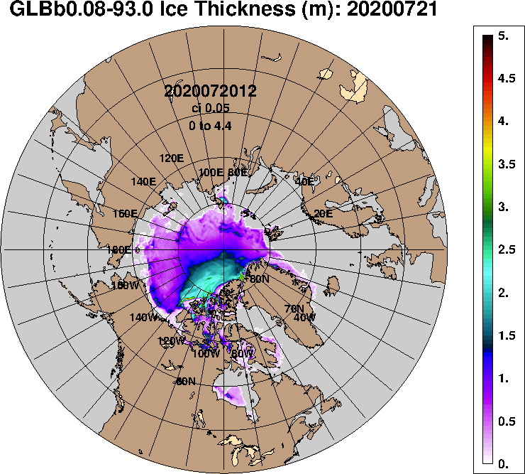
We at Sea Research Society's Environmental Affairs Department are very concerned of the melting permafrost terrain and methane clathrate deposits of the Arctic Ocean's sea bed (which are seeding Siberia's air once again with carbon-12). This is because Arctic Ocean's methane clathrates, methane (CH4) & carbon dioxide (CO₂) deposits are thought to be the world's largest reservoir of carbon. When it comes to methane, much of that in the Arctic is a side-product of geochemical processes since the birth of our planet some 4 billion years ago and so it contains ZERO radiocarbon (14C). To these are added the various undersea and land-based deposits of ancient fossil carbon which too have zero or just minute content of carbon-14.

We see already the Arctic at a tipping point, reaching a cliff edge to zero carbon-14 presence in tundra's plants emerging over recent years.

Above should set off alarm bells to archaeologists so much so that if carbon-14 can now disappear from the observed portfolio of the carbon isotopes in the plants and animals by radiocarbon-dilution effect from both the ancient geo-carbon and also the fossil carbon sources on land and sea bed. One of the key pillars to calibrate not only radiocarbon dating, but other methods as well that have been indirectly calibrated with the help of carbon-14 as their control measurements, is being attacked by the furious Mother Nature. We stand now on an increasingly elastic and shifting sands on this question. And why just now?

The answer to this is straightforward: the man-made global warming. So, now recall that the Arctic Ocean's sea level fell between some 120-130 metres from its present-day water table during the Ice Ages as water accumulated within the glaciers on the land - and that depressurisation (in addition to warming) is actually the primary route to destroy methane clathrates as it disintegrates at lower water pressures. The broad rule is therefore that the less water in ocean, the more methane clathrate (methane ice) begins to disintegrate.

Methane clathrates (methane ice deposits) as the world's biggest carbon reservoir would have inevitably oozed out copious amounts of carbon-12 into air during the lowering of the Ice Age era ocean water table. At the same time, the ice-filled and cold world oceans were mopping away gases from the air far more intensively than they do today leaving little atmospheric carbon-14 behind in this process. The atmospheric carbon is very rich in radiocarbon if compared to carbon in water courses and oceans - let alone in the ancient soils. This is because carbon-14 forms in atmosphere from nitrogen due to cosmic radiation. As cold liquids hold more gases than warmer liquids, it is not much of hocus pocus for radiocarbon to disappear from the air into these ice-filled and cold oceans teeming with much more marine life than today.

Today there are over 27,000 recorded methane craters discovered on the Arctic Ocean's sea bed and many have diameter of 1 km or wider. The largest methane crater found so far is 750 km² in its area and has the lost from its deposit thickness over 300 metres (and all of that is pure carbon-12 that was originally within methane ice, of course).

Ethnoclimatology Motion UNGA 101292 which the United Nations Secretary-General Javier Pérez de Cuéllar authorised for tabling on the floor of the UN General Assembly - as the closing plea of the opening proceedings of the first UN Year of Indigenous Peoples - stipulated a faster case history for the Ice Ages period where global warming was initially driven by methane releases from the seabed while carbon dioxide emerged later as the respondent to the warming by high altitude methane. This then tipped the trajectory of the world's constantly cooling climate at the Last Glacial Maximum towards global warming (methane molecule-to-molecule to carbon dioxide molecule is 256 times more powerful in trapping sun's heat). This system tipping point reversed the cooling of the Ice Ages from the earlier snowball-earth runaway global cooling trajectory (which resulted from the continuously advancing snow lines of the Ice Ages that were heading towards the Equator).

The last time methane came to "save the earth" from runaway freezing (snowball earth), but at our current situation we have triggered its instability by the unforeseen levels of carbon dioxide now at 420 ppm that forms a very-difficult-to-get-rid-of background climatic forcing. This issue of carbon-12 from the frozen polar regions, called cryosphere, is not just for the archaeological community and about the timing of our historic events in the distant past to be understood more accurately, but it is a real existential threat today for our society. This time methane is not coming to us from the ground as our saviour like it was during the Ice Ages, but it is now our foremost enemy after our man-made releases of carbon dioxide.

Carbon dioxide released today lingers in air for 1000 years or even more, although bouncing back-and-forth with surface layers in the oceans, but it is only very gradually disappearing from the air by chemical weathering by the olivine group rocks or soils containing olivine group minerals. Also, very deeply penetrated plant roots lock carbon gradually away as well as the sea plankton if it falls onto the deep ocean bed. It is a grave misconception to think that the plant life is a great natural filter than can sort our mess out. The plants are rather geared to take carbon in as carbon dioxide to only form their leaves, let the autumn come and those same leaves are due to fall onto the ground and turn back into carbon dioxide. Flowers and trees are not any sort of Santa Claus to do that job for us.

As carbon's locking away is not at all immediate as shown above but as it can take thousand years or more to do so, so the same principle applied to the huge releases of Palaeolithic methane (which as lighter-than-air gas resides mainly in the upper troposphere, stratosphere, and mesosphere). As most of methane has been seen in recent years accumulating at fastest rate at the highest altitudes in the atmosphere - far above the surface - it cannot be very well represented in the ice cores. It simply is neither trapped in the snow crystals very much - and consequently - nor seen in the ice cores (that are basically just taken out of the pack of compacted fallen snow) - as most of methane resides well above the cloud level.

This explains why the global warming - which ended the Ice Ages - appears in the ice cores already centuries to thousands of years before the rising concentrations of carbon dioxide is seen in air trapped in the bubbles of the ice cores. Methane oxidizes best to carbon dioxide in warm and moist air, but during the xeric climate conditions of the ice ages and also amplified by the xeric heights in dry stratosphere, methane oxidised back then far slower than it does today. Thus, the huge heating effect of methane melted the ice sheets of the Ice Ages back into the world ocean and as soon as the sea levels rose, methane clathrates got re-pressurised - while the slip-sliding and collapsing ice sheets and ice shelves produced ice bergs and more sea ice to cool both the oceans and the climate. The supply of new methane from ocean beds soon was cut off and in due course also the permafrost releases also began to diminish as climate began to cool due to growing shortage of methane in air. By Holocene Thermal Maximum or Optimum any further global warming had stopped as by then there was little high altitude methane left in upper troposphere, stratosphere, and mesosphere. As a consequence of this new tipping point, the atmospheric temperature rise ceased and settled for the Holocene equilibrium and then dropped slightly for the next few thousands of years.

The above explains, for example, the radiocarbon-outliers of the earliest Egyptian carbon samples being typically more carbon-14 aged than their actual age. Quite ridiculously, the recent discovery of wood material in relation to the Great Pyramid of Giza, which was built by Pharaoh Khufu was radiocarbon-dated to 34th century BCE. This is more than eight (8) full centuries before the historically-known date when the Great Pyramid of Giza was built.

In fact, the timing of 34 centuries before Common Era is a date that occurred long before even the Egyptian state even existed! Yet, these readings were apparently checked very carefully and cross-checked again. The explanation flirted - which we at SRS are strenuously disputing - is that the Egyptians would have stored the wood for over eight centuries before the put that wood in use to build the Khufu pyramid. This is outrageous stupidity as it is very clear that huge bulk quantities of wood would have been required and which could never have been stored for such a long time before its final use. There simpy weren't even manpower and storage facilities in the 34th century BCE Egypt. Even if the wood would have been first used in the construction of the Sakkara Pyramid, the first pyramid, and then recycled to the Great Pyramid of Giza for re-use, it still would not be sufficiently aged enough to explain the carbon-14 readings obtained as 34th century BCE.

The best (or - better to say - only) explanation to the above is the effect of lingering carbon dioxide in the air remaining centuries to over thousands of years after the Palaeolithic releases of geological and fossil carbon from the Arctic permafrost soils and seabed.

Our whole economy (along history-keeping too) stands and falls if the Arctic methane and carbon dioxide emissions of carbon-12 continue this way unabated as today. The world needs cooling urgently and far less CO₂ perhaps 350 ppm or less. Of course, there is also the separate environmental issue of Siberia's forest fires this year and last (2020 and 2021) with a forest of the size of France said to have been burnt.

Above are serious issues where historic dating of carbon is a minor issue but where the dangers from global warming to human society must remain our supreme concern.

A particularly suspicious case to us is the Japanese Palaeolithic as the island sits east of the vast Eurasian landmass and is exposed to winds from north-west that come via Siberia. In particular the Pandora's Box of permafrost carbon-12 is suspect culprit in these comments:

"Ground stone and polished tools: The Japanese Palaeolithic is unique in that it incorporates one of the earliest known sets of ground stone and polished stone tools in the world .. The tools, which have been dated to around 30,000 BC, are a technology associated in the rest of the world with the beginning of the Neolithic around 10,000 BC. It is not known why such tools were created so early in Japan. Because of this originality, the Japanese Palaeolithic period in Japan does not exactly match the traditional definition of Palaeolithic based on stone technology (chipped stone tools). Japanese Palaeolithic tool implements thus display Mesolithic and Neolithic traits as early as 30,000 BC." (Wikipedia, Japanese Palaeolithic)

The effect of carbon-12 seeding in air - as the westerly winds roll gradually over the terrain of Siberia and Arctic to pick up old carbon on its way to east - is seen to be the greatest in the north-east corner of Siberia (i.e. northern Yakutia) where the plants currently appear sucking in major permafrost inputs of ancient carbon. This would suggest that the northern China would be also quite prone to similar permafrost-based carbon-12 seeding. Then, when one accounts for the blocking effects of the Karakoram and the Himalayan mountain ranges in south and the very limited ability for the air to rise in the thin-air area over the vast Tibetan high plateau, the air is mostly guided towards South-East China that also ought see fairly elevated levels of carbon-12. This creates in my mind a question mark over the Chinese archaeological claim that they created the world's first clay pottery some 10,000-15,000 years before others - the people of the Middle East - let alone, the 'laggards' of Europe.

So, is this then another radiocarbon illusion created by the Mother Earth?

"A 2012 publication in the Science journal, announced that the earliest pottery yet known anywhere in the world was found at Xianren Cave site dated by radiocarbon to between 20,000 and 19,000 years before present, at the end of the Last Glacial Period. The carbon 14 dating was established by carefully dating surrounding sediments. Many of the pottery fragments had scorch marks, suggesting that the pottery was used for cooking. These early pottery containers were made well before the invention of agriculture (dated to 10,000 to 8,000 BC), by mobile foragers who hunted and gathered their food during the Late Glacial Maximum." (Wikipedia, Xianren Cave)

There are other issues than a lack of such old pottery findings in addition to the suggested radiocarbon-dilution effect that archeologists must consider. One reason for not finding pottery, or encountering less of it, would be the mobility and the lack of accumulation of domestic waste in heaps, "tells", as in the Middle East because the people were likely highly nomadic. It might be more practical to use wooden vessels, leather skins and avoid pots by other means like roasting meat over the open fire rather than carrying the relatively bulky clay pots (at least for anything other than for use as a cooking vessel for vegetables, seeds, roots, or herbs). Animals and fish could be roosted on rocks or over the fire as and so the need might be just for an occasional cooking pot. When to the potential mobility is added temporary camping in places away from the rivers and the streams, it is easy to miss out vast majority of pottery left behind on the huge grassland steppes of Central Asia and China.

On the other hand, the idea of clay pots could have spread far faster as useful and easy-to-copy practice to bake clay, and the large c-14 dates might be almost entirely carbon artefacts.

At British Museum's conference Anthropology, Weather, and Climate Change we presented a poster Looking at the Forward Running Clocks' - Carbon Cycles and Time from Pleistocene to Present outlining some prime candidates that we suspected as fallen for the Arctic geo-carbon and fossil carbon seeding effects (a link attached at the end).

The carbon "seeding effects" are not only localised and regional radiocarbon anomalies. There are important anomalies also outside the time scales of these seasonal and regional weather patterns - on a global climate scale. As an indicator of this, there is the already stated anomalous global warming that is seen occurring centuries-to-millennia before the rise of carbon dioxide in air trapped within the ice cores before it is enriched with carbon dioxide. This anomaly (an exceedingly toted argument by the climate change denialists) can be associated with the above said methane leaks from methane clathrates (geo-carbon and fossil carbon) from ocean bed, and methane from permafrost (fossil carbon) at very high altitudes - where the were warming the air well before carbon dioxide arrived to the scene. This carbon sourcing would have seeded also the entire overall global air mass to at least some extent with this extra carbon-12 - though somewhat less than the northern anomalies to create also a somewhat skewed background comparisons level (less "aged" than the higher permafrost emissions seen nearer their Arctic sources) but also radiocarbon-diluted.

In all this, remember, it only takes a doubling of carbon-12 in the air to add one half-life (5,730 years) to the measured radiocarbon age. If you reduce it to a quarter, that is already in the range of over 10,000 years - and it is in these ranges or even more than that - these gigantic Arctic carbon stores painted our ancient biological bodies with extra carbon-12.

We have devised some unique experiments that can fully differentiate any carbon from the above Arctic sources from the naturally occurring portfolio of the carbon isotopes.

I just got the latest methane blobs reported 02:30 am today. These images are far from good although they do not create such a television theatre or environmental porn like the forest fires, floods and hurricanes do. Yesterday's readings are "our canary in a coal mine" to show how badly methane and carbon dioxide are now streaming out from the Arctic permafrost soils and seabeds. Our past trust has been to be over-relying on plain or slightly tinkered readings how to interpret radiocarbon. This will be gone as this is how carbon-12 now enters our biological materials from Northern Asia with its culprit caught red handed.

The revised radiocarbon-oriented vocabulary on the Arctic carbon-12 emissions are: Ice Ages' Last Glacial Maximum (= Sea-Level Drop Maximum) until Holocene Thermal Maximum/Optimum (= Permafrost Melting Maximum). The past ancient methane "blobs" were in a vastly larger scales than those seen here today. As I said above, carbon dioxide concentrations could not get over 180 ppm during the Ice Ages due to the cold and iceberg and sea ice filled oceans dissolving gases from atmosphere far faster than today whilst the carbon-12 taps of lowered seabeds and then melting permafrost remained highly venting. This suppressed atmospheric carbon-14 manifestation for a very long time. Situation on graphics on Tuesday, 3 August 2021; received Wednesday, 4th August 2021 at 02:30 GMT.

Our research of ethnoclimatological records show consistent records in Sumer, India, East Asia, and Mesoamerica that the ethnic time-keeping is consistently pointing towards faster causative, duration and termination history for the Ice Ages and as per UNGA 101292. This is also at the core of my 2023 moon expedition bid to raise alarm on above dangers from the Moon to get the First Nations of Americas ethnohistorical climate recollections taken more seriously and to establish Ethnoclimatology as a new branch of science akin to Ethnobotany.


By Veli Albert Kallio, FRGS | Vice-President, Sea Research Society | Ethnoclimatologist

• United Nations General Assembly Motion 101292 for UNFCCC's Talanoa Dialogue

• 'Looking At The Forward Running Clocks' - Carbon Cycles and Time From Pleistocene to Present
https://www.academia.edu/29473262/Looking_At_The_Forward_Running_Clocks_Carbon_Cycles_and_Time_From_Pleistocene_to_Present

Former Director of the Royal Botanical Gardens at Kew, London, Professor Sir Ghillean Prance, FRS, is fully behind me on my moon flight bid to raise alarm bells on above problem. I hope a positive outcome by the end of this month to be included in the moon flight crew.

• Moon Flight Crew Interview of Veli Albert Kallio (Step 3) for SpaceX 2023 Lunar Mission

Wednesday, August 5, 2020

North Hole 2020?

Will there be open water at the North Pole in August 2020?


Above images show, on the left, sea surface temperatures on August 4, 2020, with a forecast on the right for August 9, 2020.

On the image at the left, the center of the Arctic Basin (pale-blue) still has a sea surface temperature below 0°C (or 32°F).

Around that pale-blue area is a blue area where sea surface temperatures are 0 to 2°C (or 32 to 35.6°F).

Seawater will freeze and stay frozen at about −2 °C (28 °F). The sea surface of the Arctic Ocean contains less salt, so the sea ice will stay frozen longer, even as temperatures rise, but it will melt at 0°C (or 32°F).

As the images show, the blue area where sea surface temperatures are at or above 0°C (or 32°F), is encroaching upon the pale-blue area at the center of the Arctic Basin, and appears to reach the North Pole at August 9, 2020.

Hat-tip to Albert Kallio for pointing at this.

Above combination image shows the running twelve-month averages of global-mean (top) and European-mean (bottom) surface air temperature anomalies relative to 1981-2010, based on monthly values from January 1979 to July 2020.

The shape of current anomalies is very similar to the peak reached around 2016. This in itself is alarming and it is even more alarming since the peak around 2016 was reached under El Niño conditions, whereas the July 2020 temperature was reached under ENSO-neutral conditions, as the image below illustrates.


The image below shows surface temperatures as high as 6.1°C or 42.9°F north of Greenland for August 7, 2020, with wind coming from the south-east.


The image below shows sea surface temperatures as high as 2.2°C or 36°F north of Greenland on August 7, 2020.


The image below shows Arctic sea ice volume, with the black line showing volume in 2020, up to August 12, 2020.
The dramatic decline of the sea ice becomes even more evident when looking at the fall in thickness. The navy.mil animation below was run on August 11, 2020, and shows sea ice thickness over 30 days (last 8 frames are forecasts for August 12 - August 19, 2020).


16°C (or 60.8°F) at northern tip of Greenland

The temperature was 16°C (or 60.8°F) on August 7, 2020, 10:00 am, at Kap Morris Jesup, at the northern tip of Greenland. The lowest temperature at Kap Morris Jesup over the past few days (i.e. from July 27 Jul 1:00 am — August 11, 1:00 am) was 0°C, i.e. on August 6, 2020, 7:00 pm. The average temperature at Kap Morris Jesup over this period was 8°C (or 46.4°F).

Remember that above 0°C, ice will melt. The water temperature of the Arctic Ocean underneath the sea ice is warmer, and this has been melting the sea ice from below. There still is a (rapidly thinning and shrinking) layer of sea ice at the surface of the Arctic Ocean, because until recently, air temperatures had remained low enough to maintain it, while it also takes time for the ice to melt. As long as there is ice, the heat will be consumed by the process of melting - once the ice is gone, temperatures will rise even more rapidly.

Relative humidity over this period was 69%, which means there was quite a bit of rain as well, further speeding up the melting.

The image below shows the ice at the northern tip of Greenland on August 6, 2020.


The image below shows ocean surface temperatures, with very high anomalies showing up where the sea ice has disappeared.


Above image also shows that the Arctic Ocean in many places is very shallow, which means that heat can quickly reach sediments at the seafloor, threatening to destabilize methane hydrates.

Methane levels are very high at the moment, the MetOp-1 sattelite recorded a mean methane level of 1917 ppb at 293 mb on August 4, 2020 pm, with high methane levels visible over the East Siberian Arctic Shelf (ESAS).
High methane levels were recorded over the Arctic Ocean by the MetOp-1 satellite on the morning of August 8, 2020, at 469 mb.

The situation is dire and calls for immediate, comprehensive and effective action, as described in the Climate Plan.


Links

• Danish Meteorological Institute - 5 Day Ocean Forecast - Universal (Greenwich) Time
http://ocean.dmi.dk/anim/index.uk.php

• Danish Meteorological Institute - sea ice thickness and volume
http://polarportal.dk/en/sea-ice-and-icebergs/sea-ice-thickness-and-volume

• Copernicus - Surface air temperature for July 2020
https://climate.copernicus.eu/surface-air-temperature-july-2020

• NOAA - ENSO: Recent Evolution, Current Status and Predictions - August 3, 2020
https://www.cpc.ncep.noaa.gov/products/analysis_monitoring/lanina/enso_evolution-status-fcsts-web.pdf

• Temperature at Kap Morris Jesup, the northern tip of Greenland
https://www.timeanddate.com/weather/@3421844/historic

• NASA Worldview image of northern tip of Greenland, August 6, 2020

Friday, March 20, 2020

World's Governments Must Learn About Emissions During COVID-19 Shutdown

WORLD GOVERNMENTS MUST LEARN CORONAVIRUS EMISSIONS SHUTDOWN
AS MUCH AS POSSIBLE - by Albert Kallio

Global Circulation Models (GCMs) are computer models of the world's atmosphere based on observations and assumptions if there are no direct information available.

World emissions shutdowns are a novel opportunity to learn about how climate system responds under different circumstances that cannot be normally experimentally checked. It is vitally important for the world's governments NOT to shut down meteorological measurements. Indeed, efforts must increase to use opportunity to test and search regional responses of the highly unusual situation.

World Meteorological Organisation (WMO) and national meteorological organisations must quickly come up with new research proposals to gain every possible bit of information as this helps to understand how world's climate will respond as the world moves towards ZERO emissions. It is a tremendous tragedy if this unique opportunity to find more about how our atmosphere operates is lost.

Sponsors, please look at serious proposals to make research offers right now! Let's make something positive happen out of this coronavirus calamity.


Veli Albert Kallio
Vice President, Sea Research Society
Environmental Affairs Department
https://en.wikipedia.org/wiki/Sea_Research_Society

Monday, October 17, 2016

Pursuing efforts?

Late last year at the Paris Agreement, nations pledged to hold the global average temperature rise to well below 2°C above pre-industrial levels and to pursue efforts to limit the temperature rise to 1.5°C above pre-industrial levels. On 5 October 2016, the threshold for entry into force of the Paris Agreement was achieved. The Paris Agreement will formally enter into force on 4 November 2016.


Meanwhile, as illustrated by above image, temperatures have been more than 1.5°C above pre-industrial levels for nine out of the past twelve months. For the months February and March 2016, the anomaly was actually quite close to the 2°C guardrail, while for station-only measurements, warming for February and March 2016 was well over the 2°C guardrail from pre-industrial levels.

The monthly warming in above image was calculated by using the NASA Global Monthly Mean Surface Temperature Change data (Land+Ocean) from 1880 through to September 2016, while adding 0.28°C to cater for the rise from 1900 to 1951-1980, and additionally adding 0.3°C to cater for the rise from pre-industrial to 1900.

[ click on image to enlarge ]
The 0.28°C adjustment (to cater for the rise from 1900 to 1951-1980) is illustrated by above graph, which has a polynomial trend added to the NASA Global Monthly Mean Surface Temperature Change (Land+Ocean) data from January 1880 through to September 2016.

As said, the top image has a further 0.3°C added to cater for the rise from pre-industrial to 1900, as discussed in an earlier post.


Above image shows sea surface temperature anomalies on the Northern Hemisphere, with a polynomial trend pointing at a doubling of ocean warming within one decade. Warming of the sea surface on the Northern Hemisphere threatens to speed up Arctic sea ice loss, as the Gulf Stream pushes ever warmer water toward the Arctic Ocean.


In addition, warming of the air over the Arctic Ocean occurs faster than elsewhere on Earth, as illustrated by above image and by the animation on the right.

This further speeds up the demise of the snow and ice cover, as illustrated by the images below.

Arctic sea ice extent on October 20, 2016, was at a record low for the time of the year, at only 6.15 million square km, as measured by the National Institute of Polar Research in Japan.


The images below show Arctic sea ice extent as measured by NSIDC.org (left) and average Arctic sea ice extent (year to date, October 20, 2016), from a post by Torstein Viðdalr (right).

Average Arctic sea ice extent for the period October 22, 2015 to October 20, 2016 (blue line) was lower than it was for any other 365-day period since 1978, when satellites first started measuring sea ice extent.


The images below show Arctic sea ice thickness as measured by the National Institute of Polar Research in Japan (left) and as measured by the Naval Research Laboratory (right, new model).

[ click on image to enlarge ]

Albert Kallio comments (in italics):
ARCTIC OCEAN SEA ICE GROWTH STOPS DUE TO HEAT BARRIER
The rapid growth of the sea ice has stopped because during the summer the surrounding ocean accumulated so much heat that it cannot yet freeze. Whilst the central Arctic Ocean around the North Pole saw a very rapid freezing as its broken sea ice cover quickly fused together in cold, autumn darkness breaking new records, it now has suddenly hit the opposite: a new all time record low for sea ice area for this time of season. This is because the ocean is still too warm for water to freeze around edges of the Arctic Ocean leading to all-time record low ice area that fell below or is at least in par with year 2012 low (the last record low ice year).


The image below (Arctic on the left, Antarctic on the right) was created by Daniel Kieve.
Daniel Kieve comments (in italics):
Both Arctic and Antarctic sea ice are now at record low extent for this time of year according to NSIDC data, with the Arctic sea ice over 2 million square kilometres lower than the average extent for 20th October. The Antarctic sea ice is at 2 standard deviations below the (30 year) average. At this time of year it's usually a time of rapid ice growth in the Arctic but it's stalled due to the continuance of anomalously warm air in parts of the Arctic and in particular the record warmth in the oceans that is encroaching more and more into the Arctic. This means next Summer the Arctic ice is more vulnerable than ever to collapse as the insolation reaches its peak in June and July.

Demise of the snow and ice cover in the Arctic further accelerates warming of the Arctic Ocean in a number of ways. Decline of sea ice extent makes that less sunlight gets reflected back into space and instead gets absorbed by the Arctic Ocean. Similarly, the decline of the snow and ice cover on land in the Arctic makes that more sunlight gets absorbed on land, which in turn make that warmer water from rivers flows into the Arctic Ocean. For more feedbacks, see the feedbacks page.

There's a growing danger is that further warming of the Arctic Ocean will trigger huge eruptions of methane from its seafloor. Ominously, on October 20, 2016, methane levels were as high as 2559 parts per billion, as illustrated by the image below, which also shows high methane levels over large parts of the Arctic Ocean.

The temperature rise resulting from such feedbacks has the potential to cause in mass extinctions (including humans) and destruction over the coming decade, as discussed at the extinction page.

The situation is dire and calls for comprehensive and effective action as described in the Climate Plan.


Links

 Climate Plan
http://arctic-news.blogspot.com/p/climateplan.html

 How Much Warming Have Humans Caused?
http://arctic-news.blogspot.com/2016/05/how-much-warming-have-humans-caused.html

 NASA GISS Surface Temperature Analysis (GISTEMP)
http://data.giss.nasa.gov/gistemp

 81 Parties have ratified of 197 Parties to the Convention
http://unfccc.int/paris_agreement/items/9485.php

 Paris Agreement
http://unfccc.int/resource/docs/2015/cop21/eng/10a01.pdf


Sunday, July 10, 2016

Extreme Weather Events


Sea ice close to the North Pole looks slushy and fractured into small pieces. The image below shows the situation on July 8, 2016.

Sea ice north of the geographic North Pole. For more on the (geo)magnetic North Pole, see this page
For reference, the bars at the bottom right show distances of 20 km and 20 miles. By comparison, sea ice in the same area did develop large cracks in 2012, but even in September 13, 2012, it was not broken up into small pieces, as shown by this image at a recent post.


As shown by above image, by Jim Pettit, Arctic sea ice volume has been in decline for decades. While this may look like a steady decline, chances are that the sea ice will abruptly collapse over the next two months, for the reasons described below.

The animation below, from the Naval Research Laboratory, shows Arctic sea ice thickness for 30 days up through July 8, 2016, including a forecast of 7 days.

Below is a new Naval Research Laboratory image, dated July 4, 2016
and contributed by Albert Kallio with the following description.


NORTH POLE SEA ICE DISAPPEARING VERY RAPIDLY 4.7.2016

Albert Kallio: The upgraded US Navy sea ice thickness system revealed extreme rates of sea ice pulverization and melting on 4.7.2016 which justifies a continued close attention to the developments on the Arctic Ocean. Due to virtually continuous storm centering the North Pole for weeks now, warm water upswells and sea water mixing drives base melting of icefloes besides wave actions that both wash and pulverize broken sea ice. The more pulverized sea ice becomes, the greater its 3-dimensional surface area that sits in water becomes, this easing transfer of heat from ocean to sea ice. In addition, honeycombing of ice also flushes ice with water in a stormy weather. The final factor being that most of sea ice is very recent (seasonal) ice that contain residues of salts, when saline brine is expelled this creates boreholes into ice making it "rotten ice" easily.
https://www7320.nrlssc.navy.mil/GLBhycomcice-12/navo/arcticictn_nowcast_anim30d.gif
Sea ice decline reflects the extra energy added to the Arctic, as global warming and feedbacks are hitting the Arctic particularly strongly. Three of these feedbacks are depicted in the image on the right.

As the sea ice melts, sea surface temperatures will remain at around zero degree Celsius (32°F) for as long as there is ice in the water, since the extra energy will first go into melting the ice. Only after the ice has melted will the extra energy start raising the temperature of the water.

Sea ice thus acts as a buffer that absorbs heat, preventing sea surface temperature from rising. As
sea ice is busy melting, each gram of ice takes 334 Joule of heat to change into water, while the temperature remains steady at 0°C ( 32°F).

Once all ice has turned into water, all further heat goes into raising the temperature of the water. To raise the temperature of each gram of water by one degree Celsius then takes only 4.18 Joule of heat.

In other words, melting of the ice absorbs 8 times as much heat as it takes to warm up the same mass of water from zero to 10°C. As sea ice disappears, extra energy instead goes into raising the temperature of the water, as depicted in the image on the right, and as further described at the feedbacks page as feedback #14.

Sea ice can reflect as much as 90% of the sunlight back into space. Once the ice has melted away, the water of the ocean reflects only 6% of the incoming solar radiation and absorbs the rest. Albedo change is depicted in above image as feedback #1. As Professor Peter Wadhams once calculated, warming due to Arctic snow and ice loss could more than double the net warming now caused by all emissions by all people of the world.

Professor Peter Wadhams on albedo changes in the Arctic, image from Edge of Extinction
Once the sea ice has disappeared, a lot more energy will get absorbed by the Arctic Ocean, i.e. energy that was previously reflected back into space and energy that previously went into changing ice into water.

Furthermore, as the sea ice disappears, chances increase that storms will develop that come with rain and winds that can batter and push the remaining sea ice out of the Arctic Ocean, while storms can also increase the amount of water vapor in the atmosphere and the occurrence of cirrus clouds that can trap heat.

Methane is a further feedback, depicted as feedback #2 in the image further above. As the water of the Arctic Ocean gets warmer, the danger increases that heat will reach hydrates at the seafloor and that this will trigger release of huge amounts of methane, in an additional self-reinforcing feedback loop that will make warming in the Arctic accelerate further and that threatens to escalate into a third kind of warming, i.e. runaway warming. Peter Wadhams co-authored a study that calculated that methane release from the seafloor of the Arctic Ocean could yield 0.6°C warming of the planet in 5 years (see video at earlier post).


As above image shows, methane on July 8, 2016, reached levels as high as 2655 ppb. Such high levels typically occur due to methane hydrates getting destabilized. As the sea ice disappears, the situation could get worse rapidly, as illustrated by the images below.

July 5, 2016, sea surface was as warm as 17.1°C / 62.7°F at green circle, i.e. 13.7°C / 24.7°F warmer than 1981-2011. 
These high sea surface temperature anomalies are the result of warmer water getting carried by the Gulf Stream below the sea surface of the Atlantic Ocean into the Arctic Ocean. The water carried into the Arctic Ocean is both warmer and saltier than the water at the surface, as the fresh cold meltwater forms a lid at the surface. At areas around Svalbard where the sea is rather shallow, the warmer water comes to the surface. These high anomalies thus indicate how much warmer the water now is that is entering the Arctic Ocean, as discussed in earlier posts such as this one.
image from previous post
The rapid recent rise in ocean heat is illustrated by above image, showing that oceans on the Northern Hemisphere in May 2015 through April 2016 were 0.93°C warmer than the 20th century average, whereas for the equivalent 2012 period the anomaly was merely 0.46°C. In other words, there now is more ocean heat, making the possibility of methane hydrates destabilization more threatening.

Meanwhile, the speed at which the Arctic is warming is changing the jet streams, as discussed by Paul Beckwith in the video below, following Paul's earlier video that's included in an earlier post.


There are many indications that changes to the climate are accelerating, causing extreme weather events to hit with increasing strength and intensity. Water vapor is a potent greenhouse gas and for each degree Celsius that temperatures rise, the atmosphere can hold 7% more water vapor, which will also lead to stronger storms such as cyclones. On the image below, typhoon Nepartak is approaching Taiwan, with wind speed as high as 103 mph or 165 km/h, and with cloud water as much as 9 kg per square m on July 7, 2016.

Nepartak approaching Taiwan on July 7, 2016, with wind speed as high as 103 mph or 165 km/h (left panel), and with cloud water as much as 9 kg per square m (right panel)
NASA image
According to NASA, very powerful storms near the center of Nepartak's circulation were found to be dropping rain at a rate of over 193 mm (7.6 inches) per hour. Tall thunderstorms called "hot towers" were found to reach heights of 17.0 km (about 10.5 miles).

The image on the right shows a thermal image of Typhoon Nepartak on July 7 at 17:45 UTC. The colder the cloud tops, the higher they are in the troposphere and the stronger the storms.

On July 7, 2016, at 1500 UTC, Nepartak's maximum sustained winds had reached 150 knots (172.6 mph/ 277.8 kph), generating waves as high as 48 feet (14.6 meters).

Strong storms can bring water vapor high up into the stratosphere, contributing to the formation of cirrus clouds that trap a lot of heat that would otherwise be radiated away, from Earth into space.

Altogether, the combined global temperature rise due to global warming and feedbacks could exceed 10°C or 18°F within a decade, as discussed in previous posts such as this one.

The situation is dire and calls for comprehensive and effective action as described in the Climate Plan.


Links

 The North Geographic Pole, the North Magnetic Pole and the North Geomagnetic Pole
http://wdc.kugi.kyoto-u.ac.jp/poles/polesexp.html

 Three Kinds of Warming in the Arctic
http://arctic-news.blogspot.com/2016/02/three-kinds-of-warming-in-arctic.html

 NASA: Napartak (July 9, 2016)
https://www.nasa.gov/feature/goddard/2016/napartak-nw-pacific-ocean

 Jim Pettit Climate Graphs
http://iwantsomeproof.com/3d/siv-ds-weekly-3d.asp


Monday, May 16, 2016

Further Confirmation Of Arctic Sea Ice Dramatic Fall

Since early April, 2016, there have been problems with the sensor on the F-17 satellite that provided the data for many Arctic sea ice images. On April 12, NSIDC issued a notice that it had suspended the provision of sea ice updates. On May 6, NSIDC announced that it had completed the shift to another satellite. The red dotted line in the image below shows data from the F-18 satellite from April 1 to May 15, 2016.

The JAXA site also provides sea ice extent images, obtaining data from a Japanese satellite. They show that Arctic sea ice extent on May 15, 2016 was 11,262,361 square km, 1.11 million square km less than it was on May 15, 2012.


The Cryosphere Today is still using data from the F17 satellite, showing some weird spikes. Albert Kallio has taken a recent image and removed faulty spikes, resulting in the image below showing sea ice area up to May 3, 2016.

[ yellow line is 2016, red line is 2015 ]
Importantly, above image confirms that Arctic sea ice in 2016 has indeed been very low, if not at its lowest for the time of the year. Especially since April 2016, sea ice has fallen far below anything we've seen in earlier years. Below, Albert elaborates on comparing data.


by Albert Kallio

REPAIRED USA (F-17) SATELLITE DATA SHOWS RECORD SMALL SEA ICE AREA IN MAY 2016 AGREEING JAPANESE (JAXA) DATA

A corrected Special Sensor Microwave Imager and Sounder (SSMIS) data set on the Defense Meteorological Satellite Program (DMSP) F-17 satellite that provides passive microwave brightness temperatures (and derived Arctic and Antarctic sea ice products) has been corrected here for the system instrumentation error. This agrees with the Japanese JAXA curve, and has been accomplished by removal of the uncharacteristic upward 'ice growth' spikes by linear intrapolation of the corrupt data points. This reinforces the JAXA data that shows the Northern Hemisphere sea ice area is seasonally at new record low which has continued in May 2016.

Smoothened F-17 curve agrees with the Japanese JAXA satellite curve. The reconciliation of the two has been accomplished by removal of the uncharacteristic upward spikes by linear intrapolation of the corrupt days' data points which incorrectly showed immense sea ice area growth in the middle of spring melt season. This reinforces the JAXA data that shows the sea ice area is seasonally at record lows. Therefore, media who are citing recent F-17 satellite sea ice area figures are intentionally distorting the facts with their claims of the Northern Hemisphere having a record sea ice area for this time of season - whereas in reality - the exact opposite has been happening.

Arctic sea ice is in a bad shape and looks set to deteriorate even further, for a number of reasons.

The year 2016 is an El Niño year, as illustrated by the 51.1°C (124.1 °F) forecast for May 22, 2016, over the Indus Valley in Pakistan (see image right).

Insolation during the months June and July is higher in the Arctic than anywhere else on Earth. Greenhouse gases are at record high levels: CO2 was 408.2 ppm on May 12, 2016, and methane levels are high and rising, especially over the Arctic.

Ocean heat is also very high and rising. The image below shows that oceans on the Northern Hemisphere were 0.93°C (or 1.7°F) warmer in the most recent 12-months period (May 2015 through April 2016) than the 20th century average.


The situation is further illustrated by the image below, using the NOAA data with a trendline added that points at a rise of 3°C (5.4°F) before the year 2040.


Chances are that Arctic sea ice will be largely gone by September 2016. As the ice declines, ever more sunlight gets absorbed by the Arctic Ocean. This is one out of numerous feedbacks that are hitting the Arctic. The danger is that, as these feedbacks start to kick in more, heat will reach the seafloor of the Arctic Ocean and trigger methane to be released in huge quantities from the Arctic Ocean seabed.

Recently, an abrupt methane release from the Arctic Ocean seafloor did enter the atmosphere over the East Siberian Sea, showing up with levels as high as 2578 ppb (at 586 mb on May 15, 2016, pm, see image below). Such abrupt releases are indications that methane hydrates are destabilizing and are warnings that climate catastrophe is waiting to happen.


The situation is dire and calls for comprehensive and effective action as described in the Climate Plan.


Tuesday, April 5, 2016

Record Arctic Warming

On April 3rd, 2016, Arctic sea ice extent was at a record low for the time of the year, reports the National Snow and Ice Data Center (NSIDC).

The image below, created with an image from the JAXA site, gives an update on sea ice extent.


Besides sea ice extent, sea ice area is important. For more on what constitutes "ice-covered" and what is sea ice extent (versus sea ice area), see this NSIDC FAQ page.

Another measure is sea ice area. On April 2nd, 2016, Northern Hemisphere sea ice area was at a record low for the time of the year, reports the Cryosphere Today.


In 2015, there still was more sea ice area than there is now when it was half a month later (15 days) into the year. In 2012, there still was more sea ice when it was 25 days later in the year. In other words, sea ice area decline is almost one month ahead compared with the situation in 2012.

NSIDC scientist Andrew Slater has created the chart below of freezing degree days in 2016 compared to other years at Latitude 80°N. See Andrew's website and this page for more on this.

The Arctic has warmed more than elsewhere on Earth. Surface temperatures over the past 365 days were more than 2.5°C or 4.5°F higher than they were in 1981-2010.


The image below compares sea ice thickness on April 3rd for the years 2012, 2015 and 2016 (respectively the left, center and right panel).


Sea ice thickness has fallen dramatically over the years, as illustrated by the image on the right, from NSIDC, showing Arctic sea ice age for the week from March 4 to 10, from 1985 to 2016.

The high temperatures that have hit the Arctic Ocean over the past 365 days make that the outlook for the sea ice in the Arctic this year is not good.

As illustrated by the image on the right, the current El Niño is still going strong, with temperatures above 100°F recorded in three continents.

The year 2016 is already shaping up as the warmest year on record by far.

Temperatures look set to soar over the coming months, over the Northern Hemisphere at large and over the Arctic in particular.

The image below shows that over a 90-day period from January 13, 2016, to April 11, 2016, most of the Arctic Ocean was more than 6°C (10.8°F) warmer than 1981-2011.

The DMI image below shows recent melting in Greenland up to April 11, 2016. Maps in the left panel show areas where melting has taken place on April 10 and April 11, 2016. The chart in the right panel shows 2016 melting (blue line), against the 1990-2013 average (the vertical axis reflects the percentage of the total area of the ice where the melting occurred).

As a recent study confirms, ice sheets can contain huge amounts of methane in the form of hydrates and free gas. Much methane can escape due to melting and fracturing during wild weather swings.


Rapid melting on Greenland looks set to continue. The forecast for April 12, 2016 (0000 UTC), on the right shows temperature anomalies at the top end of the scale (20°C or 36°F) over most of Greenland and Baffin Bay, while the Arctic as a whole is hit by a temperature anomaly of over 5°C (over 9°F), compared to 1979-2000.

Furthermore, ocean temperatures are currently very high. These high temperatures, together with the poor condition of the sea ice, make that chances are that the sea ice will be largely gone by September 2016.

[ click on images to enlarge them ]
The image on the bottom right shows sea surface temperature anomalies above Latitude 60°N on April 4, 2016.

The image below shows that, on April 7, 2016, sea surface in the Barents Sea was as warm as 10.1°C or 50.2°F, an anomaly of 9.4°C or 16.9°F from 1981-2011 (at the location marked by the top right green circle), while there were anomalies as high as 11.3°C or 20.3°F off the coast of North America (green circle bottom left).

The white line shows the approximate path of the cold exit current, while the red line shows the approximate path of the warm entry current.

The high temperatures in the Barents Sea give an indication of the ocean heat traveling toward the Arctic Ocean, while the high temperature anomalies off the east coast of North America give an indication of the heat that is building up there. Much of this heat will make its way to the Arctic Ocean over the coming months


April 11, 2016: SST anomalies as high as 11.6°C or 20.8°F
In the Pacific, sea surface temperature anomalies from 1981-2011 were as high as 11.6°C or 20.8°F near Japan on April 11, 2016 (see image right), giving a further indication of the huge amount of additional heat that there now is in oceans on the Northern Hemisphere. The prospect is that temperatures will rise over the next few months to levels even higher than they were last year (see earlier post on temperatures in June 2015).

Sea ice acts as a buffer, absorbing heat and keeping the temperature of the water at freezing point. Without such a buffer, further heat will instead make that the temperature of the water will rise rapidly. Furthermore, less sea ice means that less sunlight gets reflected back into space and more sunlight instead gets absorbed by the Arctic Ocean.

These are just some of the many feedbacks that accelerate warming in the Arctic. Warm water reaching the seafloor of the Arctic Ocean can penetrate sediments that can contain huge amounts of methane in the form of hydrates and free gas, triggering abrupt release of methane in gigantic quantities, escalating into runaway warming, and subsequent destruction and extinction at massive scale.

On a 10-year timescale, the current global release of methane from all anthropogenic sources already exceeds all anthropogenic carbon dioxide emissions as agents of global warming; that is, methane emissions are more important than carbon dioxide emissions for driving the current rate of global warming.


Above image shows that growth in methane levels has been accelerating recently; a trendline points at a doubling of methane levels by the year 2040. Unlike carbon dioxide, methane's GWP does rise as more of it is released. Methane's lifetime can be extended to decades, in particular due to depletion of hydroxyl in the atmosphere.

The situation is dire and calls for comprehensive and effective action as described at the Climate Plan.

Albert Kallio comments: 
More could have been added from the last National Snow and Ice Data Center (NSIDC) Arctic sea ice report for March, the general outlook for massive sea ice loss because the near-all-time record low marine snow and ice cover is coinciding with near-all-time record low terrestrial snow cover. NSIDC forecast that due to dark surfaces being so high, this easily leads to loss of sea ice. In fact, 2016 situation is even worse that it was previous record loss 2012 when snow cover was much larger. Same in 2007 when the sea ice area was slighly smaller, there was much larger terrestrial snow cover. Furthermore, neither 2007 nor 2012 occurred during strong El Nino like 1998. El Nino 2015-2016 is the strongest ever, also accompanied by the very warm Indian Ocean, Atlantic Ocean, and Southern Ocean around Antarctica. At times Antarctic sea water temperatures were also high leading to second smallest Austral summer sea ice at one point. Sea ice area also around Antarctica has been smaller than average most of time, despite increased melt water and reduced salinity - due to high temperatures. All these additional factors should be added into your conclusions without forgetting to mention that the added heat in the earth system is ripping the Polar Vortex apart as the jet streams have started to blend into other irregular atmospheric wind patters. Note also the increased flow of sea ice through the Fram Strait due to lowered spatial viscosity of sea ice that also results from larger wave action, vertical mixing of ocean by wind, thinner sea ice breaking easier apart and collapsing into pack ice, as well as being mostly seasonal ice (containing trace amounts of salts that make the chemical bounds in ice crystals weaker and fragile and melting easier), May be you can update and rejoice on NSIDC's March 2016 report noting all the points therein..