Friday, May 9, 2014

Outlook for sea ice remains bleak


In April 2014, Arctic sea ice reached its annual maximum volume. It was the second lowest on record, according to calculations by the Pan-Arctic Ice Ocean Modeling and Assimilation System (PIOMAS) at the Polar Science Center. The ice volume in March 2014 also was the second lowest on record, as discussed in an earlier post. The fall in volume over the years is illustrated in the graph below, by Wipneus.
Another way of depicting the continuing fall in sea ice volume is the Arctic Death Spiral below, by Andy Lee Robinson.

The graph below, from the Danish Metereological Institute, shows mean temperatures that have been much higher than they used to be at higher latitudes. Mean 2 m temperatures for the region north of the 80th northern parallel as a function of the day of year are shown (red line), against the 1958 - 2002 mean (green line).


High levels of methane over the Arctic will have contributed to these high temperatures. Furthermore, the Jet Stream is changing as the difference in temperature between the Arctic and the equator decreases, causing more extreme weather events such as heatwaves and storms that could speed up the demise of snow and ice cover in the Arctic.

The graph below, by the Japan Aerospace Exploration Agency, shows that Arctic sea ice extent was 12,469,546 km² on May 8, 2014.

In addition, an El Niño event could cause even more ferocious heatwaves and storms to hit the Arctic. The image below, from IRI at Columbia University, shows that the chance of an El Niño event developing in the course of 2014 is close to 80%.


The outlook for the sea ice remains bleak and the possibility that a total collapse could occur in September calls for comprehensive and effective action, as discussed at the climate plan blog.

Sunday, May 4, 2014

Will the Anthropocene last for only 100 years?

On November 9, 2013, methane levels as high as 2662 ppb (parts per billion) were recorded, as indicated by the red dot on the image below.

This image, from an earlier post, gives an idea of the height of this level compared to historic methane levels, and how fast levels of methane (CH4) have been rising compared to levels of two other greenhouse gases, i.e. carbon dioxide (CO2) and nitrous oxide (N2O).

CO2 concentrations in the atmosphere have now risen to levels well above the 400 parts per million (ppm), as illustrated by the graph below, from keelingcurve.ucsd.edu. This 400 ppm is 143% the pre-industrial peak level of 280 ppm.

Paleorecords show that greenhouse gases levels go up and down in lockstep with temperatures in history. The image below shows that carbon dioxide levels back in history typically moved between approximately 180 ppm and 280 ppm, a difference of 100 ppm. Since 1950, CO2 levels have risen by roughly the same difference.


In a fascinating lecture, Dr Jan Zalasiewicz suggests that the Anthropocene started around 1950, when levels of greenhouse gases started to rise exponentially, in line with the rise of fossil fuel use, as also illustrated by the image below.


The image below, from an earlier post, shows that temperatures typically moved up and down by roughly 10 degrees Celsius between a glacial and interglacial phase of the ice ages, suggesting that a 100 ppm rise of carbon dioxide and 300 ppb rise of methane go hand in hand with a 10°C temperature rise.

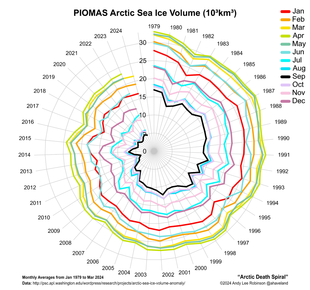
Many eminent scientists have warned that the high current carbon dioxide levels have already locked us in for a future temperature rise of several degrees Celsius, a rise that is yet to fully manifest itself and that is only held off by the temporary masking effect of sulfur dioxide that is emitted when burning fuel (especially coal) and by the (decreasing) capacity of oceans, ice sheets and glaciers to act as a buffer for heat. Once the masking effect of sulfur dioxide ends and the Arctic sea ice collapses, a huge sudden rise in temperature can be expected, hitting vulnerable pools (see image below) which would accelerate the temperature rise even more and could cause temperatures to rise by another 10°C within decades.


The scenario of such a huge rise in temperature becomes a distinct possibility when considering the combined warming impact of carbon dioxide, methane, nitrous oxide, water vapor and albedo changes, and the vulnerability of some of the terrestrial and marine carbon pools. Also note that, while the above Unesco image gives an estimate of 104 or 10,000 Gt C for ocean methane hydrates, several studies give even higher estimates, as illustrated by the image below, from Pinero et al.


The amount of carbon stored in hydrates globally was in 1992 estimated to be 10,000 Gt (USGS), while a later source gives a figure of 63,400 Gt C for the Klauda & Sandler (2005) estimate of marine hydrates. A warming Gulf Stream is causing methane eruptions off the North American coast. Furthermore, methane appears to be erupting from hydrates on Antarctica, on the Qinghai-Tibetan Plateau and on Greenland. In just one part of the Arctic Ocean alone, the East Siberian Arctic Shelf (ESAS), up to 1700 Gt of methane is contained in sediments in the form of methane hydrates and free gas. A sudden release of just 3% of this amount could add over 50 Gt of methane to the atmosphere, i.e. some seven times what is in the atmosphere now, and experts consider such an amount to be ready for release at any time.

Importantly, methane levels have risen even more strongly than carbon dioxide levels. As the image at the top of this post shows, the current methane level is 250% its pre-industrial peak level, i.e. 1100 ppb above the pre-industrial peak level of 700 ppb. Historically, methane has only moved by some 300 ppb between a glacial and interglacial phase of the ice ages. IPCC/NOAA figures suggest that global mean methane levels have been rising by 5 or 6 ppb annually over recent years and there are some worrying indications that the rise of methane levels might accelerate even further.

To obtain mean methane abundance, measurements are typically taken at an altitude of 586 mb, as methane typically shows up most prominently at this altitude. Indeed, mean methane levels were highest at this altitude in April 2013, at just under 1800 ppb. Looking at mean global methane levels in April 2014 at this altitude, one could at first glance conclude that the situation had not changed much, and that 2014 methane levels had merely risen by a few ppb, in line with IPCC data. So, at first glance one might conclude that there may appear to be only a minimal rise (if any at all) in global mean methane levels when taking measurements at lower altitudes.

The image below illustrates this. What should be added is that the analysis used only selected altitudes and only used part of all data. So, further analysis may be necessary to verify these findings.


Importantly, closer examination of above graph shows that the situation is dramatically different when looking at the rise in methane levels at higher altitudes. A huge rise in mean methane levels appears to have taken place, to the extent that the highest mean level is now reached at 469 mb. Overall, the average rise in methane across the altitudes that are highlighted in the image is no less than 16 ppb.

The table below shows the altitude equivalents in mb (millibar) and feet.
56925 feet44689 feet36850 feet30569 feet25543 feet19819 feet14383 feet8367 feet1916 feet
74 mb147 mb218 mb293 mb367 mb469 mb586 mb742 mb945 mb

As the image below illustrates, this rise appears to go hand in hand with much higher peak readings, especially at higher altitudes. It appears that the additional methane originates from the higher latitudes of the Northern Hemisphere and has over the past few months moved closer to the equator, which is what typically occurs as methane rises in altitude.


Peak readings in above image are averages over April. On specific days, peak readings could be much higher, e.g. on April 28, 2014, methane levels were recorded as high as 2551 ppb at 469 mb.

As said, there appears to be a 16 ppb rise when comparing global mean methane levels between April 2013 and April 2014. Indeed, the culprit appears to be the rapid rise of methane emissions from hydrates that has been documented by this blog and that I estimated to amount to 99 Tg annually, as illustrated by the image below, from an earlier post.


So, it appears that the rise of methane in the atmosphere is accelerating. What can we expect? As temperatures can be expected to continue to rise and as feedbacks start to kick in, this may well constitute a non-linear trend. The image below shows a polynomial trend that is contained in IPCC AR5 data from 1955 to 2011, so they didn't include this recent steep rise. Nonetheless, the polynomial trendline points at methane reaching mean global levels higher than 3000 ppb by the year 2030. If methane starts to erupt in large quantities from clathrates underneath the seafloor of the Arctic Ocean, this may well be where we are heading.
So, how high could temperatures rise? Worryingly, a non-linear trend is also contained in the temperature data that NASA has gathered over the years, as described in an earlier post. A polynomial trendline points at global temperature anomalies of 5°C by 2060. Even worse, a polynomial trend for the Arctic shows temperature anomalies of 4°C by 2020, 7°C by 2030 and 11°C by 2040, threatening to cause major feedbacks to kick in, including albedo changes and methane releases that will trigger runaway global warming that looks set to eventually catch up with accelerated warming in the Arctic and result in global temperature anomalies of 20°C+ by 2050.


Without action, it appears that the Antropocene will lead to extinction of the very human beings after which the era is named, with the Anthropocene only running from 1950 to 2050, a mere 100 years and much too short to constitute an era. In that case a better name would be the Sixth Extiction Event, as also illustrated by the image below, from an earlier post.


In conclusion, it's high time that we start acting as genuinely wise modern human beings and commit to comprehensive and effective action as discussed at the Climate Plan blog.

Saturday, April 26, 2014

M5.1 Earthquake hits Greenland Sea

An earthquake with a magnitude of 5.1 on the Richter scale hit the Greenland Sea on April 26, 2014, at 03:55:33 UTC at a depth of 10.00 km (6.21 mi). The epicenter of the earthquake is located right on the faultline that crosses the Arctic Ocean, at 73.479°N 7.974°E, some 567km (352mi) SSW of Longyearbyen, Svalbard.

[ click on image to enlarge ]
This follows four further recent earthquakes close to Svalbard or on the faultline north of Greenland, as indicated on above map. All these earthquakes struck at a depth of 10.00 km (6.21 mi).

Some of these earthquakes have also been discussed in earlier posts:
M4.6 - North of Franz Josef Land, 2014-04-13 02:12:19 UTC, also discussed in this post
M4.2 - North of Franz Josef Land, 2014-04-04 07:01:30 UTC
M4.4 - 262km NE of Nord, Greenland, 2014-04-22 10:30:23 UTC, also discussed in this post
M4.3 - 148km SSE of Longyearbyen, Svalbard, 2014-04-24 08:33:06 UTC
M5.1 - Greenland Sea, 2014-04-26 03:55:33 UTC
M4.5 - Gakkel Ridge, 2014-03-06 11:17.17.0 UTC, also discussed in this post

There have been a large number of earthquakes around Greenland since early 2014, as illustrated by the image below. This could be an indication of isostatic rebound, as also discussed in this earlier post.

[ click on image to enlarge ]

As melting of the Greenland Ice Sheet speeds up, isostatic rebound could cause earthquakes around Greenland to become stronger and occur more frequently. Earthquakes in this region are very worrying, as they can destabilize hydrates contained in the sediment under the seafloor of the Arctic Ocean. Furthermore, one earthquake can trigger further earthquakes, especially at locations closeby on the same faultline.

Tuesday, April 22, 2014

M4.4 Earthquake hits Arctic Ocean north of Greenland

An earthquake with a magnitude of 4.4 on the Richter scale hit the Arctic Ocean north of Greenland on April 22, 2014, at 10:30:23 UTC at a depth of 10.00 km (6.2 mi).

[ click on image to enlarge ]
The epicenter of the quake is located right on the faultline that crosses the Arctic Ocean, at 83.328°N 4.568°W, 262km (163mi) NE of Nord, Greenland.

The earthquake follows another earthquake that hit the Arctic Ocean closeby on this faultline, on April 13, 2014, north of Franz Josef Land.

Earthquakes at this location are very worrying, as they can destabilize hydrates contained in the sediment under the seafloor of the Arctic Ocean. Furthermore, one earthquake can trigger further earthquakes, especially at locations closeby on the same faultline.

Arctic Sea Ice in Steep Descent

Arctic sea ice area is in steep descent, as illustrated by the image below. Sea ice area was only smaller at this time of the year in 2007, for all years for which satellite data are available.

[ click on image to enlarge ]
Earlier this year, on March 9, 2014, Arctic sea ice area was at a record low for the time of the year. Since then, area did show some growth for a while, to the north of Scandinavia. This growth could be attributed largely to strong winds that made the sea ice spread with little or no growth in volume. The 30-day Naval Research Laboratory animation below shows recent sea ice speed and drift.


Indeed, sea ice volume in March 2014 was the 2nd lowest on record. Only March 2011 had a lower volume as discussed in a recent post. The 30-day Naval Research Laboratory animation below shows recent sea ice thickness. 


Low sea ice volume and area jointly suggest there could be a total collapse of the sea ice later this year, in line with observation-based non-linear trends. For years, this blog has warned that observation-based projections point at Arctic sea ice disappearance within years, with dire consequences for the Arctic and for the world at large.

As said, winds are responsible for much of sea ice variability, and winds could either slow down or speed up such a collapse. On this point, it's good to remember what Prof. Peter Wadhams said in 2012:
". . apart from melting, strong winds can also influence sea ice extent, as happened in 2007 when much ice was driven across the Arctic Ocean by southerly winds. The fact that this occurred can only lead us to conclude that this could happen again. Natural variability offers no reason to rule out such a collapse, since natural variability works both ways, it could bring about such a collapse either earlier or later than models indicate.

In fact, the thinner the sea ice gets, the more likely an early collapse is to occur. It is accepted science that global warming will increase the intensity of extreme weather events, so more heavy winds and more intense storms can be expected to increasingly break up the remaining ice, both mechanically and by enhancing ocean heat transfer to the under-ice surface."
The image on the right, produced with NOAA data, shows mean coastal sea surface temperatures of over 10°C (50°F) in some areas in the Arctic on August 22, 2007.

In shallow waters, heat can more easily reach the bottom of the sea. In 2007, strong polynya activity caused more summertime open water in the Laptev Sea, in turn causing more vertical mixing of the water column during storms in late 2007, found a 2011 study, and bottom water temperatures on the mid-shelf increased by more than 3°C (5.4°F) compared to the long-term mean.

Another study found that drastic sea ice shrinkage causes increase in storm activities and deepening of the wind-wave-mixing layer down to depth ~50 m (164 ft) that enhance methane release from the water column to the atmosphere. Indeed, the danger is that heat will warm up sediments under the sea, containing methane in hydrates and as free gas, causing large amounts of this methane to escape rather abruptly into the atmosphere.

Such warming would come on top of ever-warmer water that is carried by the Gulf Stream into the Arctic Ocean and that has already been blamed for large methane releases from the seafloor of the Arctic Ocean last year.

The prospect of an El Niño event, as discussed in an earlier post, makes the situation even more dire.

The consequences of sea ice collapse will be devastating, as all the heat that previously went into transforming ice into water will be asbsorbed by even darker water, from where less sunlight will be reflected back into space. The danger is that further warming of the Arctic Ocean will trigger massive methane releases that could lead to extinction at massive sclae, including extinction of humans.

Hopefully, more people will realize the urgency of the situation and support calls for comprehensive and effective action as discussed at the Climate Plan blog.

Wednesday, April 16, 2014

Near-Term Human Extinction

Global Warming and Feedbacks

Is there a mechanism that could make humanity go extinct in the not-too-distant future, i.e. within a handful of decades?

Most people will be aware that emissions due to human activity are causing global warming, as illustrated by the arrow marked 1 in the image on the left. Global warming can cause changes to the land, to vegetation and to the weather. This can result in wildfires that can in turn cause emissions, thus closing the loop and forming a self-reinforcing cycle that progressively makes things worse.

Furthermore, less forests and soil carbon also constitute a decrease in carbon sinks, resulting in carbon that would otherwise have been absorbed by such sinks to instead remain in the atmosphere, thus causing more global warming, as illustrated by the additional downward arrow in the image on the right. In conclusion, there are a number of processes at work that can all reinforce the impact of global warming.

Emissions can also contribute more directly to land degradation, to changes in vegetation and to more extreme weather, as indicated by the additional arrow pointing upward in the image on the right. A recent study by Yuan Wang et al. found that aerosols formed by human activities from fast-growing Asian economies can cause more extreme weather, making storms along the Pacific storm track deeper, stronger, and more intense, while increasing precipitation and poleward heat transport.

Accelerated Warming in the Arctic

Similar developments appear to be taking place over the North Atlantic. Huge pollution clouds from North America are moving over the North Atlantic as the Earth spins. In addition, the Gulf Stream carries ever warmer water into the Arctic Ocean. As the image below shows, sea surface temperature anomalies at the highest end of the scale (8 degrees Celsius) are visible off the coast of North America, streching out all the way into the Arctic Ocean.


As said, feedbacks as are making the situation progressively worse. Feedback loops are causing warming in the Arctic to accelerate. Warming in the Arctic is accelerating with the demise of the snow and ice cover in the Arctic, and this is only feedback #1 out out many feedbacks that are hitting the Arctic, as described in an earlier post. As the temperature difference between the equator and the Arctic decreases, the Jet Stream is changing, making it easier for cold air to move out of the Arctic and for warm air from lower latitudes to move in (feedback #10).


Abrupt Climate Change leading to Extinction at Massive Scale

The danger is that, as temperatures over the Arctic Ocean warm up further and as the Gulf Stream carries ever warmer water into the Arctic Ocean, large quantitities of methane will erupt abruptly from the seafloor of the Arctic Ocean, adding a third kind of warming, runaway warming resulting in abrupt climate change, and leading to mass death, destruction and extiction of species including humans.

Persistence of such a progression makes it inevitable that the rest of Earth will follow the huge temperature rises in the Arctic. Massive wildfires will first ignite across higher latitudes, adding further greenhouse gas emissions and causing large deposits of soot on the remaining snow and ice on Earth, with a huge veil of methane eventually spreading around the globe. The poster below, from an earlier post, illustrates the danger.

[ click on image to enlarge - note that this is a 1.8 MB file that may take some time to fully load ]
Views by Contributors

How likely is it that the above mechanism will cause human extinction within the next few decades? What views do the various contributors to the Arctic-news blog have on this?

Guy McPherson has long argued that, given the strengths of the combined feedbacks and given the lack of political will to take action, near-term human extinction is virtually inevitable.

In the video below, Paul Beckwith responds to the question: Can climate change cause human extinction?


Further contributors are invited to have their views added to this post as well. While many contributors may largely share Paul Beckwith's comments, it's important to highlight that contributors each have their own views, and this extends to their preference for a specific plan of action.

Geo-engineering

One of the more controversial issues is the use of geo-engineering. Guy McPherson doesn't believe geo-engineering will be successful. In the video below, Paul Beckwith gives his (more positive) views on this.


I must admit that the lack of political will to act is rather depressing, especially given the huge challenges ahead. So, I can understand that this can make some of us pessimistic at times. Nonetheless, I am an optimist at heart and I am convinced that we can get it right by giving more support to a Climate Plan that is both comprehensive and effective, as discussed at ClimatePlan.blogspot.com

Monday, April 14, 2014

M4.5 Earthquake hits Arctic Ocean

An earthquake with a magnitude of 4.5 on the Richter scale hit the Arctic Ocean on April 13, 2014, at 02:12:19 UTC at a depth of 10.00 km (6.21 mi).


The epicenter of the quake is located right on the faultline that crosses the Arctic Ocean, at 86.687°N 45.393°E, some 800 km north of Franz Josef Land.

Earthquakes at this location are very worrying, as they can destabilize hydrates contained in the sediment under the seafloor of the Arctic Ocean. Furthermore, one earthquake can trigger further earthquakes, especially at locations closeby on the same faultline.