Showing posts with label heat. Show all posts

Monday, October 14, 2019

Arctic Ocean October 2019


Above image shows temperatures north of 80°N. The red line on the image shows the 2019 daily mean temperature up to Oct 13, 2019. The temperature is now well above the 1958-2002 mean (green line). The image also shows the freezing point of fresh water (273.15K, 0°C or 32°F, blue line).

The freezing point for salt water is lower, at around -2°C, or 28.4°F, or 271.2°K. In other words, a rise in the salt content of the water alone can make ice melt, i.e. even when the temperature of the water doesn't rise.


Above combination image shows forecasts for October 26, 2019. The left panel shows that air temperatures (2 m) are forecast to be 5.4°C higher over the Arctic than 1979-2000. Parts of the Arctic Ocean where there is no sea ice are forecast to be especially hot, since this is where heat gets transferred from the Arctic Ocean to the atmosphere. Anomalies are as high as 30°C, the top end of the scale. Temperature anomalies are in line with changes to the Jet Stream, as illustrated by the forecast in the right panel.


As above image shows, there was very little sea ice north of Greenland on October 11, 2019. Arctic sea ice extent is very low. As the image below shows, Arctic sea ice extent was 4.88 million km² on October 13, 2019, the lowest on record for the time of year.

[ click on image to enlarge ]

As the image below shows, the heat rising from the Arctic Ocean is such that sea ice extent is hardly growing.


The image below shows Arctic sea ice extent for the years, 1980,1990, 2010, 2012 and 2019, for the period as indicated.


The image below indicates that Arctic sea ice volume has been at record low levels for the time of year for some time.

Rising temperatures of water in the Arctic Ocean cause the sea ice to melt away from below. The image below, created with NOAA 2007-2019 June-September sea surface temperature data, shows heating of the sea surface on the Northern Hemisphere, with an ominous trend added.


The image indicates that a critical tipping point was crossed this year, with the disappearance of the thick sea ice that hangs underneath the surface.


This indicates that the buffer has gone that has until now been consuming ocean heat as part of the melting process. As long as there is sea ice in the water, this sea ice will keep absorbing heat as it melts, so the temperature will not rise at the sea surface. The amount of energy absorbed by melting ice is as much as it takes to heat an equivalent mass of water from zero to 80°C.

[ click on image to enlarge ]
The situation is so precarious because hot, salty water keeps flowing into the Arctic Ocean, at a time of year when the sea ice is growing in extent and sealing off the surface of the Arctic Ocean, thus reducing the heat that can get transferred to the atmosphere.

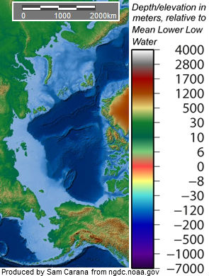
How hot is that water flowing into the Arctic Ocean? The image on the right shows sea surface temperature anomalies. On October 13, 2019, the sea surface near Svalbard at the green circle was 18.3°C or 65°F, i.e. 14.7°C or 26.4°F hotter than 1981-2011.

This is an indication of how hot the water is underneath the sea surface. At the sea surface, water gets colder due to evaporation and rain, resulting in a lid of fresh water at the surface sealing off hot and salty water underneath.

This hot and salty water moves underneath the sea surface in line with the deeper parts of the ocean, to emerge at this area near Svalbard (marker in the image below), as the water at this area becomes more shallow, making the sea current push the water to the surface.


Back in 2011, a study by Micha Ruhl et al. pointed at huge methane releases from clathrates during the end-Triassic mass extinction event, as discussed in an earlier post. The danger is that, in the absence of thick sea ice, hot water with a high salt content will reach the seafloor of the Arctic Ocean, making it easier for ice in cracks in sediments at the seafloor to melt, resulting in huge methane releases.

[ from an earlier post ]
Ominously, methane levels as high as 2961 parts per billion were recorded by the MetOp-2 satellite on October 24, 2019, in the afternoon at 469 mb.


The situation is dire and calls for comprehensive and effective action, as described in the Climate Plan.


Links

• Climate Plan
https://arctic-news.blogspot.com/p/climateplan.html

• Critical Tipping Point Crossed In July 2019
https://arctic-news.blogspot.com/2019/09/critical-tipping-point-crossed-in-july-2019.html

• Most Important Message Ever
https://arctic-news.blogspot.com/2019/07/most-important-message-ever.html

• Arctic Ocean overheating
https://arctic-news.blogspot.com/2019/09/arctic-ocean-overheating.html

• How extreme will it get?
https://arctic-news.blogspot.com/2012/07/how-extreme-will-it-get.html

• Warning Signs
https://arctic-news.blogspot.com/2018/03/warning-signs.html

Saturday, September 14, 2019

Critical Tipping Point Crossed In July 2019


In July 2019, a critical tipping point was crossed. July sea surface temperatures on the Northern Hemisphere were 1.07°C above what they were during the 20th century, as illustrated by above image which has a trend added that points at 5°C above the 20th century by 2033.

Why is 1°C above 20th century's temperature such a critical tipping point for the sea surface on the Northern Hemisphere? Let's first take a look at where global heating is going.


Oceans are absorbing over 90% of global heating, as illustrated by above image. Due to the high greenhouse gas levels resulting from people's emissions, oceans keep on getting hotter, and given oceans' huge heat-absorbing capacity, it has taken many years before this tipping point was crossed.

In July 2016, the tipping point was touched at 0.99°C. In July 2017, the July temperature anomaly was on the tipping point, at exactly 1°C. In July 2018, the sea surface was a bit cooler, and the tipping point was crossed in July 2019 when the temperature anomaly was 1.07°C above the 20th century average.


Arctic sea ice used to absorb 0.8% of global heating (in 1993 to 2003). Ocean heat keeps flowing into the Arctic Ocean, carried by ocean currents, as illustrated by above image. As peak heat arrives in the Arctic Ocean, it melts sea ice from below.

The image below shows sea surface temperatures on August 13, 2019 (left) and on September 9, 2019 (right). The light blue line forms a line indicating the sea surface temperature there is 0°C. That light blue line has moved pole-ward in September, due to rivers that kept adding warm water and also due to more warmer water entering the Arctic Ocean from the Atlantic Ocean and the Pacific Ocean.


As above image also shows, the sea surface near Svalbard was 20.4°C (or 68.7°F) at the area marked by the green circle on August 13, 2019 (left), and 20.3°C (or 68.5°F) on September 9, 2019 (right), indicating how high the temperature of the water can be underneath the surface, as it moves into the Arctic Ocean. In other words, further ocean heat is still entering the Arctic Ocean.

From mid August 2019, ocean heat could no longer find any sea ice to melt, since the thick sea ice that hangs underneath the surface had already disappeared. A thin layer of sea ice at the surface was all that remained, as air temperatures didn't come down enough to melt it from above.


This indicates that the buffer has gone that has until now been consuming ocean heat as part of the melting process. As long as there is sea ice in the water, this sea ice will keep absorbing heat as it melts, so the temperature will not rise at the sea surface. The amount of energy absorbed by melting ice is as much as it takes to heat an equivalent mass of water from zero to 80°C.

The image below, created with NOAA 2007-2019 June-August sea surface temperature data, shows how extra heating of the sea surface on the Northern Hemisphere from 2012 caused the buffer to disappear and the 1°C tipping point to be crossed in 2019.


Once the buffer is gone, further heat arriving in the Arctic Ocean must go elsewhere.


The image below illustrates the difference in extent between the years, as recorded by ads.nipr.ac.jp. On September 13, 1980, Arctic sea ice extent was 7.77 million km². On September 17, 2019, Arctic sea ice extent was 3.96 million km². On September 16, 2012, extent was 3.18 million  million km².


Arctic sea ice will soon be growing in extent, sealing off the water, meaning that less ocean heat will be able to escape to the atmosphere.


This situation comes at a time that methane levels are very high globally. Mean global methane levels were as high as 1911 parts per billion on September 3, 2019, as discussed in a recent post. This post, as well as many earlier posts, also discussed the danger that ocean heat will reach sediments at the seafloor of the Arctic Ocean and cause huge methane releases.

Ominously, methane levels at Barrow, Alaska, were very high recently, as illustrated by above image showing methane levels peaking at over 2500 parts per billion. The satellite image below shows the global situation on the afternoon of September 13, 2019, when peak methane levels as high as 2605 ppb were recorded by the MetOp-1 satellite at 586 mb.


In the videos below, Paul Beckwith discusses the situation.


The situation is dire and calls for comprehensive and effective action, as described in the Climate Plan.


Links

• Climate Plan
https://arctic-news.blogspot.com/p/climateplan.html

• Arctic Sea Ice Gone By September 2019?
https://arctic-news.blogspot.com/2019/07/arctic-sea-ice-gone-by-september-2019.html

• July 2019 Hottest Month On Record
https://arctic-news.blogspot.com/2019/08/july-2019-hottest-month-on-record.html

• Cyclone over Arctic Ocean - August 24, 2019
https://arctic-news.blogspot.com/2019/08/cyclone-over-arctic-ocean-august-24-2019.html

• Most Important Message Ever
https://arctic-news.blogspot.com/2019/07/most-important-message-ever.html

• Arctic Ocean overheating
https://arctic-news.blogspot.com/2019/09/arctic-ocean-overheating.html


Monday, April 1, 2019

An infinite scream passing through nature


Wind patterns on March 30, 2019, resembled what Edvard Munch wrote in his diary in 1892, i.e. "I sensed an infinite scream passing through nature", a feeling Munch expressed in his iconic artwork The Scream, part of which is added on the right in above image.


Indeed, at the end of March 2019, it felt like an infinite scream passing through nature! On March 31, 2019, 12:00 UTC, the Arctic was 7.7°C or 13.86°F warmer than 1979-2000, as above image shows, while in parts of Alaska the anomaly was at the top end of the scale, i.e. 30°C or 54°F above 1979-2000, as discussed in an earlier post.

What caused this to eventuate? Firstly, as the Arctic is warming faster than the rest of the world, the temperature difference between the North Pole and the Equator is narrowing, which is slowing down the overall speed at which the jet stream is circumnavigating Earth, while it also is making the jet stream wavier, enabling warm air from the Atlantic Ocean and Pacific Ocean to more easily enter the Arctic, while also enabling cold air from the Arctic to more easily descend over Asia and North America.


At the same time, global warming is making oceans warmer. Sea surface temperatures were high in the path of the jet stream on March 15, 2019, as above image shows. The sea surface was 10.8°C or 19.4°F warmer than 1981-2011 at the green circle in the left panel of above image. On that day, surface air temperature there was as high as 7.9°C or 46.2°F, and there were cyclonic wind patterns, as the right panel of above image shows.

High sea surface temperatures are causing winds over oceans to get much stronger than they used to be at this time of year.

The image on the right shows that, on March 15, 2019, the jet stream reached speeds as high as 386 km/h or 240 mph at the green circle. These stronger winds then collide at high speed with the air in front of them. This collision occurs with an even greater force, due to low temperatures over North America and due to the lower overall speed at which the jet stream circumnavigates Earth. All this makes that air gets strongly pushed aside toward the Arctic and the Equator.

On March 30, 2019, strong winds pushed warm air into Bering Strait, resulting in temperatures as high as 2.5°C or 36.4°F, as the image below illustrates.


On March 30, 2019, Arctic sea ice extent fell to a record low for the time of year, as discussed in an earlier post. Ominously, methane reached peak levels as high as 2,967 ppb on March 29, 2019, as the image below shows.


With Arctic sea ice extent this low and with temperatures rising relentlessly, fears are that the sea ice won't be able to act as a buffer to absorb heat for long, and that a strong influx of warm, salty water will reach the seafloor of the Arctic Ocean and trigger methane eruptions from destabilizing hydrates.

The situation is dire and calls for comprehensive and effective action, as described at the Climate Plan.


Links

• Arctic Warming Up Fast
https://arctic-news.blogspot.com/2019/03/arctic-warming-up-fast.html

• Climate Plan
https://arctic-news.blogspot.com/p/climateplan.html


Sunday, March 31, 2019

Arctic Warming Up Fast

On March 30, 2019, Arctic sea ice extent was 13.42 million km², a record low for the measurements at ads.nipr.ac.jp for the time of year.


[ click on images to enlarge ]
As the Arctic warms up faster than the rest of the world, the temperature difference between the North Pole and the Equator narrows, making the jet stream wavier, thus enabling warm air over the Pacific Arctic to move more easily into the Arctic.

The image on the right shows that, on March 31, 2019, the Arctic was 7.5°C or 13.5°F warmer than 1979-2000.

The earlier forecast below shows a temperature anomaly for the Arctic of 7.6°C or 13.68°F for March 31, 2019, 12:00 UTC and in places 30°C or 54°F warmer. The inset shows the Jet Stream moving higher over the Bering Strait, enabling air that has been strongly warmed up over the Pacific Ocean to move into the Arctic.


A wavier Jet Stream also enables cold air to more easily move out of the Arctic. The inset shows the Jet Stream dipping down over North America where temperatures lower than were usual were recorded.

The later forecast below shows a temperature anomaly for the Arctic of 7.7°C or 13.86°F for March 31, 2019, 12:00 UTC.


The image below shows that El Niño can be expected to push temperatures up higher in 2019 during the Arctic sea ice retreat.

A warmer sea surface can cause winds to grow dramatically stronger, and they can push warm, moist air into the Arctic, while they can also speed up sea currents that carry warm, salty water into the Arctic Ocean.

Rivers can also carry huge amounts of warm water from North America and Siberia into the Arctic Ocean, as these areas are getting hit by ever stronger heatwaves that are hitting the Arctic earlier in the year.

With Arctic sea ice at a low, it won't be able to act as a buffer to absorb heat for long, with the danger that an influx of warm, salty water will reach the seafloor and trigger methane eruptions.

As warmer water keeps flowing into the Arctic Ocean and as air temperatures in the Arctic are now starting to rise on the back of a strengthening El Niño, fears for a Blue Ocean Event in 2019 are rising, which would further accelerate the temperature rise as less sunlight gets reflected back into space.

The situation is dire and calls for comprehensive and effective action, as described at the Climate Plan.

Links

• Arctic sea ice extent
https://ads.nipr.ac.jp/vishop/#/extent

• Climate Reanalyzer
https://climatereanalyzer.org

• ENSO Update by Climate Prediction Center / NCEP 25 March 2019
https://www.cpc.ncep.noaa.gov/products/analysis_monitoring/lanina/enso_evolution-status-fcsts-web.pdf

• Blue Ocean Event
https://arctic-news.blogspot.com/2018/09/blue-ocean-event.html

• Climate Plan
https://arctic-news.blogspot.com/p/climateplan.html


Monday, November 26, 2018

Dangerous situation in Arctic

In the North Pacific, the flow of warmer water is clearly visible (see images right, green circle left).

In the North Atlantic, huge amounts of heat are moving into the Arctic Ocean (green circle right).

At some spots, heat that is traveling underneath the sea surface comes to the surface (green circle at the top).

Most warming caused by people's emissions goes into oceans, especially into the top layer of oceans.

Furthermore, warmer air and warmer sea surfaces can cause winds to grow dramatically stronger. As the Arctic is warming much faster than the rest of the world, the narrowing difference between the temperatures at the North Pole and the Equator is decreasing the speed at which winds circumnavigate Earth; at the same time, the amount of heat that is moving north can grow dramatically, both due to winds and sea currents, and cyclones can further accelerate this.

The danger is that an influx of warm salty water will reach the seafloor and trigger methane eruptions.

The situation is especially critical in many parts of the Arctic Ocean where the water is very shallow. Some 75% of the East Siberian Arctic Shelf (ESAS) is shallower than 50 m (see maps on the right).
[ warm water from the Atlantic Ocean is
increasingly invading the Arctic Ocean ]


The danger here is huge, for numerous reasons, incl.:

• shallow waters can warm up very rapidly in case of an influx of warm water;

• these shallow seas are now covered by ice, so the heat cannot escape to the atmosphere;

• sea ice is very thin, so the sea ice won't act as a buffer to absorb the heat;

• methane rising through shallow waters will pass through the water column and enter the atmosphere more quickly;

• in shallow waters, large abrupt releases will more quickly deplete the oxygen in the water, making it harder for microbes to break down the methane;

• hydroxyl levels over the Arctic are very low, which means that it takes much longer for methane over the Arctic to get broken down.

The four videos below provide a good introduction into the various issues and illustrate how dangerous the situation is in the Arctic.

Each video is part of a talk between Dave Borlace and Peter Wadhams.

Part 1 discusses albedo change in the Arctic and associated changes such as jet stream changes.


Part 2 discusses the threat of huge methane releases in the Arctic.


Part 3 discusses the thermohaline circulation and methods that could improve the situation such as carbon removal and Ocean Mechanical thermal Energy Conversion (OMTEC).


Part 4 discusses sea level rise and fires.


The situation is dire and calls for comprehensive and effective action, as described at the Climate Plan, i.e. multiple lines of action implemented in parallel and locally where possible.


Links

• As El Niño sets in, will global biodiversity collapse in 2019?
https://arctic-news.blogspot.com/2018/11/as-el-nino-sets-in-will-global-biodiversity-collapse-in-2019.html

• Doomsday by 2021?
https://arctic-news.blogspot.com/2018/11/doomsday-by-2021.html

• Climate Plan
https://arctic-news.blogspot.com/p/climateplan.html

• Feedbacks
https://arctic-news.blogspot.com/p/feedbacks.html

• Extinction
https://arctic-news.blogspot.com/p/extinction.html

• Seismic Events
https://arctic-news.blogspot.com/p/seismic-events.html

• Can we weather the Danger Zone?
https://arctic-news.blogspot.com/2018/07/can-we-weather-the-danger-zone.html

• How much warmer is it now?
https://arctic-news.blogspot.com/2018/04/how-much-warmer-is-it-now.html

• What Does Runaway Warming Look Like?
https://arctic-news.blogspot.com/2018/10/what-does-runaway-warming-look-like.html

• Peaks Matter
https://arctic-news.blogspot.com/2018/08/peaks-matter.html

• Warning of mass extinction of species, including humans, within one decade
https://arctic-news.blogspot.com/2017/02/warning-of-mass-extinction-of-species-including-humans-within-one-decade.html


Friday, August 3, 2018

Peaks Matter

Heat stress

When calculating how much warmer we can expect it to get, climate models typically use linear projections based on temperature averages, such as annual global average temperatures, daily temperatures that are averages between day and night, etc. Sadly, this downplays the danger, as average temperatures are unlikely to kill people. When lives are at stake, peaks matter!

Where are temperatures rising most?


Temperatures are rising most strongly in the Arctic. Above map shows a rise of as much as 5.7°C or 10.26°F in Arctic.

Ocean heat on the move toward Arctic Ocean

The image below shows that the sea surface was 22°C or 71.6°F on August 13, 2018, at 77.958°N, 5.545°E (near Svalbard), i.e. 6.9°C or 12.4°F warmer than 47 days earlier and 16.4°C or 29.5°F warmer than it was during 1981-2011.


Local maximum temperatures can be good indicators for the maximum heat stress that can be expected in the area.


As illustrated by above image, the sea surface near Svalbard was 22°C or 71.6°F at the green circle on August 13, 2018, i.e. 16.4°C or 29.5°F warmer than 1981-2011.

This high sea surface temperature is an indicator of the temperature of the water below the surface, which in turn is an indicator of the amount of ocean heat that is entering the Arctic Ocean from the Atlantic Ocean.

Ocean heat is carried by the Gulf Stream from the North American coast toward the Arctic Ocean, as illustrated by the images below and on the right.

Warming of the Arctic Ocean comes with a number of feedbacks that accelerate this warming, such as albedo changes that take place as the Arctic snow and ice cover declines, and methane that is released from sediments containing methane in the form of hydrates and free gas.


The situation could get worse rapidly. As an example, with a decrease in cooling aerosols, which are concentrated in the Northern Hemisphere, the North Atlantic looks set to absorb more heat. A recent study calculated that the North Atlantic’s share of the uptake could increase from 6% to about 27%.

As another example, a recent study concludes: Existing models currently attribute about 20% of the permafrost carbon feedback this century to methane, with the rest due to carbon dioxide from terrestrial soils. By including thermokarst lakes, methane becomes the dominant driver, responsible for 70% to 80% of permafrost carbon-caused warming this century. Adding thermokarst methane to the models makes the feedback’s effect similar to that of land-use change, which is the second-largest source of manmade warming.

High methane levels warn about seafloor methane releases

The image on the right illustrates the danger, showing high methane levels at Barrow, Alaska, in July 2018.

When making projections of heat stress, it is important to look at all potential warming elements, including albedo changes, changes to jet streams and sea currents, higher levels of methane, high levels of water vapor, etc.

Methane is a potent greenhouse gas, causing huge warming immediately after entering the atmosphere, while this warming will be felt most strongly where the methane was released. Methane can therefore contribute strongly to local temperature peaks.

On August 6, 2018, mean global methane levels were as high as 1896 ppb. On August 8, 2018, they were as high as 1898 ppb.

Importantly, peak levels on the afternoon of August 6, 2018, were as high as 3046 ppb, as illustrated by the image on the right. The likely origin of those high levels is the Arctic Ocean, which should act as a stark warning of things to come.

Further contributors to heat stress

Next to temperature, humidity is of vital importance. A combination of high temperatures and high humidity is devastating.

A recent study shows that the risk of deadly heat waves is significantly increased because of intensive irrigation in specific regions. The study points at a relatively dry but highly fertile region, known as the North China Plain — a region whose role in that country is comparable to that of the Midwest in the U.S. That increased vulnerability to heat arises because the irrigation exposes more water to evaporation, leading to higher humidity in the air than would otherwise be present and exacerbating the physiological stresses of the temperature.

The image below shows a forecast of perceived temperatures in China on August 7, 2018.


The green circle highlights an area that is forecast to score high on the 'Misery Index' and that is centered around a location on the coast of Poyang Lake, which is connected to the Yangtze River. Temperatures there are forecast to be as high as 36.4°C or 97.4°F. At first glance, this may not look very high, but a relative humidity 68% is forecast to make it feel like 54.1°C or 129.3°F. This translates into a wet-bulb temperature of 31.03°C or 87.86°F.

The image on the right shows relative humidity. Also note the cyclones lined up on the Pacific Ocean. Cyclones can increase humidity, making conditions worse.
The high sea surface temperature anomalies that are common in the West Pacific (image right)  contribute to warmer air and stronger cyclones carrying more moisture toward Asia, as discussed in this facebook thread which also features the next image on the right, showing that cyclone Soulik is forecast to cause waves as high as 18.54 m or 60.8 ft near Japan on August 20, 2018.

If humidity kept rising, a temperature of 36.4°C at a relative humidity of 91% would result in a wet-bulb temperature of 35°C. No amount of sweating, even in the shade and in front of strong winds or a fan, can cool the body under such conditions, and it would be lethal in a matter of hours in the absence of air conditioning or cold water.

There are further factors that can contribute to make specific areas virtually uninhabitable. The urban heat effect is such a factor. El Niño is another one. Land-only temperature anomalies are higher than anomalies that are averaged for land and oceans. As temperatures keep rising, heat waves can be expected to intensify, while their duration can be extended due to jet stream blocking.

The situation is dire and calls for comprehensive and effective action as described in the Climate Plan.


Below, Paul Beckwith warns that parts of the world 'will soon be rendered uninhabitable'.


Video: Unrelenting Heat, Humidity Will Soon Make Regions UNINHABITABLE

Paul Beckwith: "How hot can it actually get? What is in store for us? When you combine the heat domes sitting over many countries with high humidity, many areas around the planet will soon reach the deadly 35°C (95°F) 100% humidity (wet bulb temperature) or equivalent situation whereby a perfectly healthy person outside, in a well ventilated area, in the shade will die from the heat in 6 hours."

Video: Most Mammals Endure Heat Waves Better Than Humans

"Most people, like the very young, the elderly, and the rest of us won’t last anywhere as long, at even lower temperatures. I discuss the latest peer-reviewed science on how parts of high-risk regions in the North China Plains, Middle East, and South Asia will soon be rendered uninhabitable by combined heat and humidity."

Video: Uninhabitable Regions with Extreme Heat and Humidity


Also watch this video, in which Guy McPherson talks about the way aerosols currently mask the full wrath of global warming.

Video: Edge of Extinction: Rate Matters

Above video is also incorporated in the video below.

Video: McPherson's Paradox

and for the bigger picture, also watch the video below.

Video: Responding to Abrupt Climate Change with Guy R. McPherson


Links

• It could be unbearably hot in many places within a few years time
https://arctic-news.blogspot.com/2016/07/it-could-be-unbearably-hot-in-many-places-within-a-few-years-time.html

• Feedbacks
https://arctic-news.blogspot.com/p/feedbacks.html

• Latent Heat
https://arctic-news.blogspot.com/p/latent-heat.html

• How much warming have humans caused?
https://arctic-news.blogspot.com/2016/05/how-much-warming-have-humans-caused.html

• The Threat
https://arctic-news.blogspot.com/p/threat.html

• Extinction
https://arctic-news.blogspot.com/p/extinction.html

• Climate Plan
https://arctic-news.blogspot.com/p/climateplan.html